How Aerial Survey Drones are Going to Revolutionize the Oil and Gas Industry
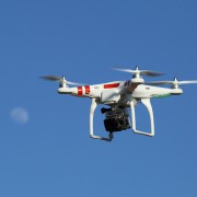
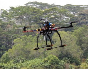 It’s no secret that the oil and gas industry is changing: “easy oil” reserves are getting more and more difficult to find, and companies therefore need to find new and innovative ways to drive more efficient operations in order to remain profitable. Unmanned aerial vehicles (UAVs), also known as drones, are the latest technology that’s driving the oil and gas industry forward, giving companies new opportunities to increase their efficiency, effectiveness and profitability.
UAV technology is not exactly new, but it’s only been in recent years that the drones, the batteries they are powered by, and the photography equipment they use to conduct land surveys have become lightweight and affordable enough to be feasible for use in large-scale land surveying operations for the oil and gas industry. This means that we’re currently standing at a crossroads in the history of the industry: those companies that identify UAV technology as the great opportunity it is and prepare themselves to capitalize on it will be in the best position to succeed going forward, while those that don’t will risk falling behind.
While there are a variety of ways in which aerial survey drones can benefit the Oil and Gas industry, one area that will be particularly impacted is land surveying. UAVs can offer three main benefits over more traditional surveying methods:
- The ability to complete land surveys quicker
- The ability to create land surveys that have a much higher level of detail
- The ability to complete land surveys without having to put surveyors in danger
Complete Land Surveys Quicker
One of the clear advantages that UAV surveying offers over traditional surveying methods is the speed at which the surveys can be completed. This is a key benefit, as land surveying is only one of the first steps of many involved with completing an oil and gas project. When the land surveying process can be completed quicker, the rest of the project can proceed as planned, and the company can reach its goals with no delays.
UAV surveying is quicker than traditional surveying because it does not require surveyors to travel over difficult terrain in order to get to the survey site. Instead, the drones are able to travel directly to the site in the air, and then allow surveyors to see the visuals they need, no matter where those surveyors are.
Provide a Higher Level of Detail
Today’s aerial survey drones use top-of-the-line photography technology to provide the high level of detail needed to create a quality land survey. While surveyors operating from the ground might miss out on important details, drones have the ability to look down on a site from above, getting a complete view of everything.
These drones can also change camera angles or move in closer to get a better view of something if necessary. As a result, using drones to help complete land surveys allows oil and gas companies to get a better view than they would otherwise, and therefore increases the chances that a project will be successful.
Keep Surveyors Off Of Dangerous Terrain
Finally, using unmanned aerial vehicles removes the need for surveyors to travel over difficult terrain in order to complete their work. This has a dual benefit of keeping surveyors safe and avoiding accidents that can lead to costly and time-consuming delays.
On the job site, keeping workers safe is always the highest priority. That’s why drone technology, which allows land surveyors to complete their work from a safe position, is such a promising technology for use in the oil and gas industry. Since it also provided quicker, more detailed surveys, UAV technology is a real no-brainer for the oil and gas industry.
To learn more about groundbreaking surveying technologies like aerial survey drones, download our oil and gas brochure.
Image Source: Michael MK Khor

