What Does a 3D Model Created by Drones Provide?

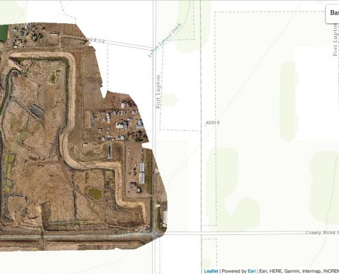
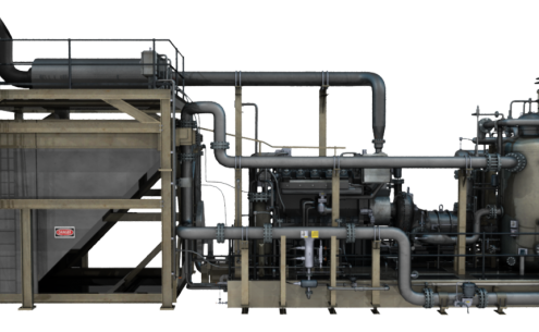
A 3D model for your oil and gas construction project can provide a variety of benefits. By allowing you to see an exact representation of the terrain where you’ll be building or the existing structure that you’ll be renovating, a 3D model can help you make informed decisions based on complete visibility.

The most common method of gathering the data needed to create 3D models is to use laser scanning, where a series of scanners pass laser points off of a 3D surface and then measure the flight path of the lasers as they return to create a data point cloud. In the past, these laser scanners would traditionally be set up on the ground surrounding the feature being scanned. Of course, the data these terrestrial scanners provided would still be valuable for creating the 3D model. However, the adoption of 3D laser scanning using unmanned aerial vehicles—commonly known as drones—has taken a good thing and made it even better. Read on to learn the advantages of getting a drone 3D model for your project.

Gather Complete and Accurate Data Quickly

One of the main challenges that land surveyors face when working on major oil and gas projects is the need to gather complete and accurate data, without the process taking too long. A very time-consuming land survey will inevitably lead to delays in actually deploying the project plan, which will, in turn, prevent the project from providing a return on investment as quickly as it might otherwise.

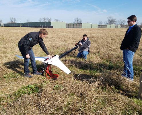
The adoption of UAV technology has proved invaluable in this regard. Unlike terrestrial scanners, UAVs can keep moving as they scan, allowing the scanners to capture large swaths of data from multiple angles in a relatively short period of time. Laser scanners don’t require the time-consuming breakdown and movement of equipment that might be required with traditional terrestrial scanners, which means they present a much more attractive option for the modern organization that’s increasingly concerned with the speed of their data capture.

The data captured by UAV laser scanners can be processed and made available for organizations to use in as little as 24 hours. As a result, this new technology helps ensure that organizations don’t have to choose between speed and accuracy when creating their 3D models.

Easily Scan Hard-To-Reach Areas

Another important advantage of getting a drone 3D model for your oil and gas construction project is the simple fact that UAVs can travel over the area being scanned as the crow flies. This means that difficult-to-reach areas need not present an impediment to gathering complete and accurate data, as they might with traditional scanning methods.

First, crossing difficult terrain to perform terrestrial scanning can be extremely time-consuming. As mentioned previously, wasting time is something that should be avoided as much as possible during the land surveying process. Also, difficult terrain can present a serious injury hazard for traditional scanning teams; UAVs are the safer option, as they don’t require the surveyors to cross the difficult terrain to scan it.

Finally, UAVs are simply able to capture more data in these areas. Unlike land-based scanners, there’s no area they can’t fully scan and no angle they’re unable to capture. The result improved laser scans is, of course, better 3D models. Using a more detailed 3D models will, in turn, enable better decision making, allowing project leaders to feel confident their project plan is based on accurate assumptions.

landpint-UAV-CTA

A Look at How Drones Have Changed GIS Mapping Services

Everywhere you look, there’s more evidence of the fact that we are living in the era of the drone. While these machines have traditionally been used for military purposes—and come with a multimillion dollar price tag as a result—a new generation of more affordable drones is now revolutionizing a variety of industries.

One of the most dramatic examples of this phenomenon can be found in the world of GIS mapping services. With unmanned aerial vehicles (UAVs), companies involved with GIS mapping services are now able to do things they would never have dreamed of before.

Filling in The Sweet Spot

To be clear, UAVs aren’t responsible for creating new GIS mapping applications. In fact, anything you can do with GIS mapping and drones could also be done using other data collection methods. The difference is that UAVs provide a quicker, less expensive, and more hassle-free way to gather the data that GIS mapping services require. As a result, GIS mapping can now be used in a variety of industry settings where it might not have been practical before.

UAVs fill a sweet spot in the realm of data collection that was seriously underserved up until now.  In the past, companies involved with GIS mapping services had to choose between two contrasting data collection methods, both of which have serious drawbacks. Specifically, they could choose between satellites/manned aircraft, which cover large areas quickly but can be expensive and doesn’t provide very detailed data, and terrestrial data collection teams, which provide the highest level of detail possible, but can have a relatively long turn-around time. There was no third option to provide the ideal mix of highly detailed data, speed, and low costs.

That’s all changed with the advent of  affordable UAVs. The reason that drones have been so revolutionary in GIS mapping services is that they can get much closer to the ground than satellites or manned aerial vehicles can, leading to much higher levels of detail and accuracy; at the same time, they are also quicker and less expensive to use than traditional terrestrial land surveying methods. Drones are simply a perfect fit for the needs of GIS data collection, so it’s no surprise to see so many new companies rushing to take advantage of this transformative technology.

Lowering Barriers to Success

One of the main issues preventing UAV land surveying from catching on any quicker than it already has is the fact that the industry has been hampered by government regulations, as is so often the case with groundbreaking new technologies. In the United States, the FAA maintains responsibility over UAVs and has been slow to establish regulations specifically covering the use of drones. Even today, it can sometimes be challenging for drone operators to know exactly what their rights and limitations are when it comes to using UAVs to support GIS mapping services.

The regulations surrounding the use of drones in industry settings are among the key reasons it can still be helpful to work with a certified professional drone operator, in spite of the fact that drones have become more affordable and easier to operate over the years. Selecting a land surveying partner that employs certified drone operators is the best way to ensure that your company doesn’t do anything it shouldn’t be doing during the process of aerial data collection. As a result, you’ll be able to get the data you need without opening your company up to legal trouble.

If you’re interested in getting started with UAV data collection for GIS mapping services, contact the professionals at Landpoint today. We look forward to the opportunity to help you cut costs, save time, and gather more detailed data.

landpint-UAV-CTA

How Does 3D Aerial Mapping Work?

For companies operating in the oil and gas industry, the potential benefits of 3D modeling are clear: when these organizations are able to look at clear, accurate and detailed representations of a piece of land or a facility, it can become much easier for them to make plans, while also feeling confident that any assumptions they make are accurate. One great way to capture the data needed to create 3D models is to use unmanned aerial vehicles (UAVs). Read on to get a quick look at what’s involved with 3D aerial mapping, on a step-by-step basis.

Step 1: Consider Conditions

Of course, using the latest technology and proper technique is important to get great results from your 3D aerial mapping process, but that alone can’t make up for suboptimal conditions. Before you schedule your drone flights to collect the needed data for your 3D models, make sure you think about what time of day would be ideal to capture the best images. Typically, you would want to fly around noon, since that would put the sun directly overhead, and shadows would, therefore, be very short. On the other hand, if you fly too early or too late in the day, the shadows would be more likely to interfere with the accuracy of the model.

In addition, make sure to check the weather for the day you intend to fly, as this can also affect the quality of the images you collect. Of course, rain or wind could make it difficult to fly in the first place, while a very sunny day would also contribute to longer shadows. Ideally, you would fly on an overcast day.

Step 2: Capture Nadir Images

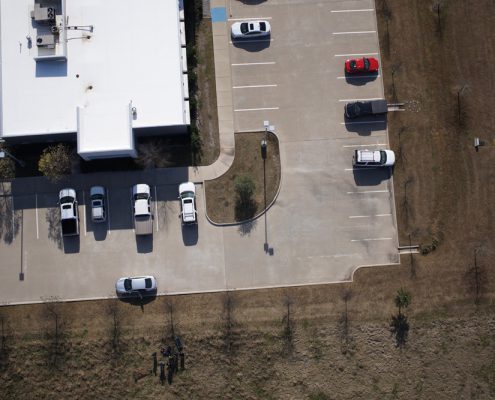
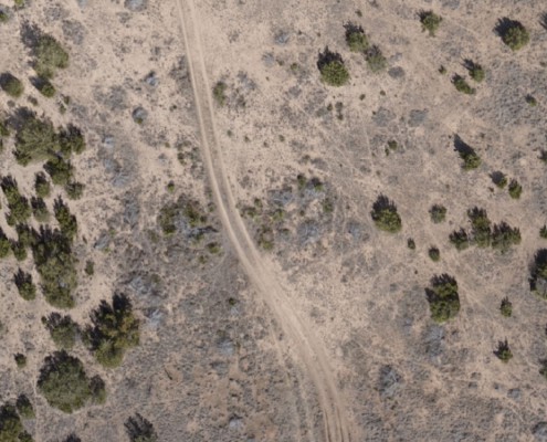
The first images you want your drone to capture when you’re doing 3D aerial mapping are the nadir images, or the images looking down on the terrain or building from directly above. These images will form the baseline of your 3D models. In most cases, it will be quite easy to design an automated flight plan for your drone to capture nadir images. Once the flight plan has been created, you can just let the drone take off on the flight path you set out for it and it will collect the formatted imagery.

Step 3: Capture Oblique Images

Since you’re looking to get a 3D view of the feature in question, viewing it from directly overhead may not always provide adequate perspective. If you’re looking at a piece of terrain that’s relatively flat, then you might be able to get away with using the nadir images alone. However, if you’re looking to model a facility or terrain that has differing altitudes, then you would want to expand on your original nadir images with oblique images.

Oblique images are captured from the side, allowing you to pick up on details you would have missed if you used nadir images alone. You would usually capture these images by flying your drone in a circle around the site, with the camera tilted at a 45-degree angle.

Step 4: Process the Images and Create the Model!

After you’ve captured an array of images from multiple angles, you can use processing software to take those images and stitch them together into a single 3D representation of the feature you were scanning. If you work with the right software, you may be able to turn your images into a usable model in as little as a few hours.

Final Thoughts

3D aerial mapping is something that anyone can do, provided that they take the time to gather knowledge and experience. If you don’t have time to learn how to do it for yourself, then an experienced 3D aerial mapping partner can help. Contact us at Landpoint today to get started.

CTA-Landpoint-UAV

How 3D Laser Scanning Services Revolutionized the As-Built Survey

Like many other areas of the construction industry, the as-built survey has been revolutionized by the advent of new technologies, and companies that adopt these technologies early on have the opportunity to get the edge on their competition. One technology in particular, 3D laser scanning has had a huge impact on as-built surveys in recent years.

With 3D laser scanning, a scanner bounces laser points off a building or terrain and then tracks the flight paths of those points as they return to the scanner. By assembling millions of these data points into a point cloud, organizations get a very detailed and accurate representation of the feature they were scanning, which can be used to support the creation of a detailed and accurate as-built survey.

Get All the Data You Need Up Front

One of the major advantages of 3D laser scanning services for as-built surveys is that they allow all the data you might need to be collected in a single streamlined scanning session, often in only a day or two of scanning work. After that point, they can work with the data from the comfort of their office, without having to return to the site to collect additional data. This can be especially helpful if your project plan changes in the future, as you’ll already have all the data you need to make new plans.

As Good as Being There

3D laser scanning provides some of the most accurate surveying data possible, which in turn means that the as-built surveys you create with that data will be accurately dimensioned as well. As-built surveys created from the results of 3D laser scanning are the most accurate representation of a feature that an organization can create. As a result, it represents the next best thing to being there. Project team members can create plans for how to update systems or install new ones while feeling completely confident that their plans are based on accurate dimensions.

Quick, Cheap and Easy

Estimates show that 3D laser scanning can capture more accurate data than traditional surveying methods while taking about 50 to 70 percent less time. In addition, the survey data can be captured by an individual working alone, rather than requiring a team of surveyors working together. Since 3D laser scanning requires fewer man hours to complete than traditional surveying, it can be significantly less expensive.

Useful for a Variety of Purposes

As this post outlines, 3D laser scanning services for as-built surveys offer a variety of benefits over traditional surveying methods. It’s no surprise to see them catching on in a variety of industry settings, for many different purposes. For instance, as-built surveys created using 3D laser scanning services can be used on new construction projects to create an exact representation of the finished facility. This can be preserved and referred to later on, in case you ever decide to retrofit the facility to add new systems.

On the other hand, these 3D scanning as-built surveys can also be quite useful for historical preservation. 3D laser scanning allows you to create new drawings of the facility in precise detail. This can be very helpful because in many cases, there are no existing drawings of these buildings. Since there were typically no templates available at the time of construction, each window, wall, or doorway could each have its own dimensions unlike one another. This is why 3D laser scanning as-built surveys will help you ensure you will have the most accurate dimensions as possible as you do your preservation work.

To learn more about 3D laser scanning services and how they could help you, contact Landpoint today.

landpoint-cta

Want a Drone Survey for a Pipeline Project? Consider These Four Things

If you’re planning a pipeline construction project, and you’ve heard about the benefits that unmanned aerial vehicles (UAVs) can offer during the land surveying process, then you’re certainly not alone. As UAVs become more affordable, they are becoming a popular tool for land surveying. Project managers are flocking to UAVs as a means to lower costs, speed up the land surveying process, and ensure data accuracy. However, in order to take advantage of these benefits, it’s important that you take the time to do things the right way. Read on to learn several things you should consider before using a drone survey for your pipeline project.

1. Does the Surveyor Employ Certified Drone Operators?

First and foremost, we are living in a world where almost anyone can acquire an inexpensive drone and start offering their services as a UAV surveyor.  It is true that drone technology has grown more accessible in recent years, but it’s still very important to make sure you work with a qualified, sUAS certified professional.

Working with a certified drone pilot will help make sure that the data you capture is accurate and that your organization complies with all local regulations in the process. As a result, you won’t have to worry about any unpleasant surprises that might come from breaking laws that you didn’t know existed. Additionally, using a licensed surveyor who operates drones will ensure the data is accurate and actually usable on a project.

2. Does the Surveyor Use the Latest Drone Technology?

So many of the benefits of getting a drone survey depend on using the latest technology and working with a team that knows how to get the most out of that technology. Modern UAVs can move faster and capture more accurate data than their older counterparts. Since pipeline projects require you to survey long distances, and pick up the most complete, accurate data possible along the way, drawing from the most advanced technology is especially important.

3. Is the UAV Surveyor Experienced with the Jurisdictions in Question?

One of the unique challenges of pipeline projects is that they tend to cover very long distances while passing through many different local jurisdictions in the process. Each of these jurisdictions will have their own unique UAV requirements, and these requirements must be properly accounted for during the UAV surveying process. Working with a surveying provider that has been there before can take a lot of pressure off your shoulders.

4. Does the UAV Surveyor Offer End-To-End Data Services?

While the data collection portion of the land surveying process is certainly important, you also need to ask yourself what comes after that. Are you given the raw data and then simply expected to figure out how to use it yourself?

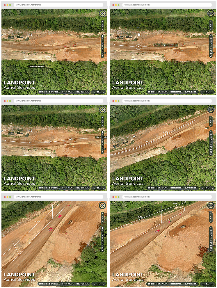
Ideally, you would work with an end-to-end UAV service provider, that would not only help you collect the data, but also process it for you promptly, store it in a secure location, and then distribute it using a centralized cloud platform that allows users from across the organization to pull needed data and documents. This last point is especially important for pipeline projects; since field teams can be spread out and disconnected from office teams, making it easy for everyone to pull from the same data source is essential.

Landpoint for UAV Surveying Services

The key takeaway from this post is that who you choose to work with for your UAV land surveying services can mean the difference between success and failure. At Landpoint, we’re ready for the opportunity to prove to you that we can offer all the benefits you need from a trusted surveying partner. Contact us today to get started.

landpint-UAV-CTA