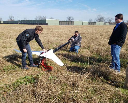
A (Quick) Guide to Hiring an Aerial Land Surveyor for a Pipeline Project

Completing a land survey is one of the biggest challenges a project leader will face in the runup to a pipeline construction project. The survey must be quick, accurate, and cost-effective to get the project off to the best possible start. Hiring an aerial land surveyor that uses unmanned aerial vehicles (UAVs) can help you balance these priorities. UAVs work faster than traditional surveying teams, and use the latest technologies to capture detailed and accurate land data. Read this blog post for a closer look at the benefits of working with an aerial land surveyor for your pipeline project.

Once you’ve decided that an aerial land surveyor is right for you, you’ll want to do your homework and make sure you work with the right one. Read on for tips on how you can evaluate potential surveying partners.

Does the surveyor use the latest drone technology and produce survey-grade data?

One of the biggest challenges that project leaders face when trying to hire a surveying partner is separating the hobbyists from the serious professionals. With UAVs becoming less expensive over time, more and more people are starting to think they have what it takes to perform land surveying services. However, there is a clear difference between the work of experienced UAV operators flying the latest technology, and the work of amateurs.

Only the professional can provide the survey-grade data you need to make informed decisions based on accurate assumptions. In the world of pipeline land surveying, “close enough” simply doesn’t exist. Only precise and detailed data will do, and only aerial land surveyors who have invested in the latest data-gathering technologies can provide that kind of data to you.

Does the aerial land surveyor employ certified UAV operators?

The UAV space has long been subject to government regulations. While these regulations have made life a bit more difficult for people looking to source data quickly and cost-effectively, they are also necessary to ensure that UAVs are operated safely.

Cutting corners by hiring someone who isn’t an sUAS-certified UAV pilot may not seem like a big deal, but it’s important to be aware of some of the potential consequences of such a decision. For one, what you don’t know can hurt you. This means that if a UAV operator working on behalf of your company doesn’t follow all applicable laws and guidelines while working on your project, your company may face legal complications as a result. Hiring a certified UAV operator is the best way to avoid these kinds of complications.

Is the land surveyor an end-to-end service provider?

After your aerial land surveyor collects the data your pipeline requires, then what happens? Do they simply perform a data dump and expect for you to handle the rest? Ideally, you would work with an end-to-end service provider that not only helps you gather your land data but also helps you use it as well.

As we said previously, completing the survey process quickly is one of the key goals for any project leader. However, the process isn’t truly complete until the data has been fully processed and stored. An end-to-end service provider can ensure that this happens with no delay. In addition, such a partner can make sure your data is stored securely, while also guarantee that you can access it when needed.

Final Thoughts

Like in any other area of the oil and gas business, who you choose to work with can make the difference between success and failure for your pipeline surveying. The tips provided in this post can help you make sure you choose the right surveyor. To learn more or get started, contact Landpoint today.


landpint-UAV-CTA

What Will Professional Land Surveying Look Like 5 Years From Now?

Like all other industries, professional land surveying is being disrupted by the emergence of new technologies. These technologies allow surveyors to complete their work in better ways. Over the coming years, as these technologies go from being cutting edge to commonplace, it will have a great effect on the way construction project managers get the land surveys they need to be successful. In this post, we’ll be taking a look forward in an attempt to get a better understanding of what the surveying landscape might end up looking like five years from now.

UAVs Will Play a Greater Role

Unmanned aerial vehicles (UAVs) have become increasingly affordable in recent years, opening the door for them to be used for a variety of industry applications that might have been considered cost prohibitive before. Professional land surveying provides a perfect example of just such an application.

Using UAVs, commonly known as drones, surveying teams can enjoy a number of benefits over traditional land surveying techniques such as manned aircraft or terrestrial surveying teams. For one, UAVs can cover even very large areas relatively quickly. Also, they are able to fly over difficult terrain and capture up-close images, neither of which could be accomplished using traditional methods. The result is that organizations get accurate, complete data quickly, allowing them to proceed with confidence.

Expect to see drones becoming the industry standard over the next few years. As more land surveyors embrace the technology, it will transition from “competitive edge” to “business necessity.” While traditional surveying will still factor into the process, much, if not most, of the surveying process will be handled by UAVs.

Data Will Be Available Instantly

Another technology with exciting implications for the world of professional land surveying is 3D laser scanning, commonly known as LiDAR. This technology works by having a series of scanners emit millions of laser points, and then tracking the flight path of those laser points as they return to the scanner. The results of that tracking are then formed into a data point cloud, which organizations can use to create extremely detailed 3D models or survey documents.

While LiDAR has been around for some time, there have been some exciting advances in the technology recently. For example, surveyors may soon be able to produce point clouds in real time. Some LiDAR systems already have this capability, and we should expect to see it grow less expensive (and therefore more widely available) as time goes on. Access to data in real time will empower project leaders to dramatically speed up the surveying process, which in turn helps prevent delays in the project schedule.

Cloud-Based Data Storage Will Become the Norm

One of the tradeoffs of new, more detailed scanning technologies is the fact that they create volumes of data that are much larger than what today’s organizations are accustomed to dealing with. As these technologies become more commonplace, organizations must rethink the way they approach data storage if they hope to keep up.

Fortunately, technology has an answer for this as well. With cloud-based data storage, organizations can quickly scale the amount of data they manage, without having to make large capital investments to build out their own storage infrastructure. Instead, they can pay a manageable monthly fee to a cloud service provider, who can scale their storage up or down as needed. Alternatively, land surveyors have already started offering their own cloud based platforms, saving their clients the hassle of requisitioning their own storage.

In addition, cloud supports the reality of the modern distributed workforce. Team members will be able to access data from wherever they happen to be, on any device. This ensures that in the future, all team members will be able to say on the same page.

Final Thoughts

At Landpoint, we’re working hard to build the future of land surveying today. Contact us to learn more about how we can apply the capabilities outlined in this post to help you.

Landpoint-CTA-Survey

How Technology Can Help Cut Oil and Gas Development Costs

Many leaders in the oil and gas development space are looking to do everything they can to keep their costs as low as possible. In many ways, the surveying portion of a large oil and gas project provides many of the best opportunities for cost savings. In addition to requiring a significant amount of manpower (which of course contributes to higher costs), surveying that takes too long can also give rise to delays in the project schedule, which in turn increases the wait required for the project to become profitable.

Fortunately, there are many new technologies available today that can help contribute to a more cost-effective surveying process. In this post, we’ll take a quick look at just a few of them.

Unmanned Aerial Vehicles (UAVs)

Unmanned aerial vehicles, commonly known as drones, have begun to be adopted in a wide variety of industry applications, with land surveying being among the most promising. Simply put, using UAVs to gather land data instead of traditional terrestrial teams can help significantly speed up the surveying process, leading to a quicker return on investment.

UAVs can travel as the crow flies, capturing images of large swaths of land as they go. Unlike surveyor teams on land, they aren’t slowed down by difficult terrain. In addition, the land surveying data that UAVs collect can be processed and turned around for the project team to use within 24 hours. As a result, the days of waiting for surveying data to be completed before moving forward with a project are a thing of the past.

Finally, using a single UAV operator in place of a team of surveyors leads to lower labor costs in the land surveying process.

3D Laser Scanning

With 3D laser scanning, land surveying teams can quickly gather extremely detailed and accurate representations of the land where an oil and gas development project will be built. In turn, this data can be used to build 3D models of that land. This will allow project leaders to decrease guesswork and make more informed, confident decisions.

3D laser scanning can contribute to lower costs for oil and gas development projects by ensuring that the project team makes the right decision the first time. Making decisions based on inaccurate assumptions will inevitably lead to time-consuming and costly rework. Building 3D models with the results of their laser scanning allows project leaders to create a plan that makes the most of both time and resources.

Cloud Data Storage

While new technologies such as UAVs and 3D laser scanning have clear benefits, they also create the challenge of generating massive amounts of data. As a result, oil and gas project leaders need to store that data in a manner that’s secure and cost-effective, while also ensuring that those who do need access to that data can get it. Fortunately, cloud data storage is able to meet these needs.

First, storing survey data on the cloud allows organizations to remove the burden of building their own storage infrastructure. In place of building their own data center—complete with very high up-front costs—the cloud allows project teams to take advantage of someone else’s data center, while simply paying a more manageable monthly fee. In addition, the cloud provides universal access to the data that team members need to do their jobs, on any device at any time. As a result, team members can make the most effective use of the time they spend working.

In Conclusion

Working with a land surveying partner that provides a complete, end-to-end surveying solution is the best way to take advantage of all these powerful technologies at once. Contact Landpoint today to learn more about how we can help you.

Landpoint-CTA-New-(1)