Tips for Choosing High Definition 3D Laser Scanning Services

Speed, cost, and accuracy — there are many factors you need to consider when you’re choosing a high-definition, 3D laser scanning service. If you find the right service, you won’t need to compromise between these very critical factors. However, you’ll need to take care to find the right service and the solution. Here are some of the most important benefits you should consider when comparing different services.

Request UAV-Acquired Data

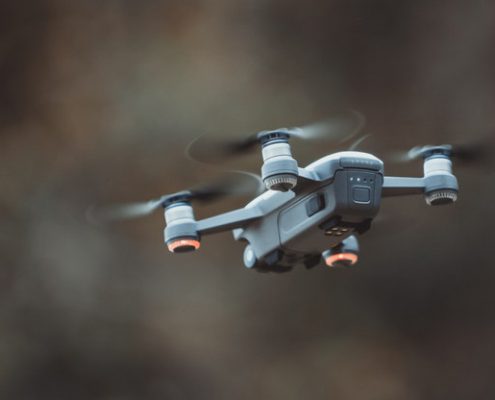
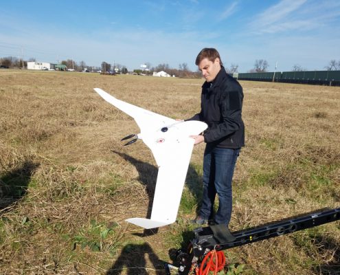
Chances are good that you have heard about drones being used for aerial data collection. UAVs can collect extraordinary amounts of data extremely quickly and can drill down to get very high-resolution scans. While a traditional, terrestrial laser scan may still be needed in some cases, most surveys can now be done by drone.

When it comes to high definition laser scanning services, accuracy is extraordinarily important. Low-resolution scans conducted either high up by plane or low to the ground may make it more difficult to complete simulations and analyze the relevant data.

Get the Latest, Most Accurate Scanning Technology

It may be worth it to consider the age of the scanning technology that your service is using. As the number of LiDAR applications grows (think cutting-edge technology like self-driving cars), so too does the technology. Data processing tools can now be used to automatically identify certain landscape features, drilling down to architectural and engineering features and offering not only scans but simulations that depict the surrounding area.

Organizations that use the latest technologies will be able to provide the most value to your business by offering scans that are not only of a higher quality but also faster and more cost-effective.

Look for Fast, Streamlined Data Processing

Organizations that complete end-to-end data analysis and processing, such as Landpoint, are preferred, as they can move from surveying and scanning directly to creating representations and simulations of your scanned space. The more streamlined a process is, the less likely you are to run into issues and roadblocks or need to wait as data is transferred from one entity to another to be processed.

If you want to reduce the chances of error and improve the general accuracy and efficiency of your operations, it’s best to work with a single data scanning and analysis company. An organization that has fast turnaround times and is able to analyze and process data in as few steps as possible is going to fit into your operating workflows more easily.

Find a Service With Online Data Sharing

Online data sharing, including SaaS solutions and integration with other third-party products, can make life easier for your organization. Through online data sharing, your organization can easily disseminate data to all of your offices. Your ideal high-resolution scanning service should be able to provide your data in a format that is easy for your organization to plug into its workflow.

In addition to online data sharing, you may want to look for third-party integration that works with the software suites that you have available, such as industry standards including CAD platforms. This will make it easier for you to import and work with the data once it has been completed and analyzed, and sidestep issues of conversion and further analysis.

High-definition 3D laser scanning has undergone developed quote a bit in the past decade. Higher resolution imaging is available at lower costs and increased accuracy, but you still need to be able to find a reliable partner to work with. If you’re looking high-definition 3D Laser scanning services, consider inquiring with Landpoint today.

Oil-and-Gas-eBook-CTA

Need a Land Survey For an Oil And Gas Project? Think Landpoint

The Land surveying sector is undergoing some drastic changes in terms of technology. In the past, land surveying was often a time-consuming, costly process. New technologies have arisen that make the process faster and easier, especially in important, high volume industries such as the oil and gas industry.

Technology is one of the things that distinguishes Landpoint from other surveyors. Landpoint realizes that oil and gas companies increasingly need more accurate data, faster turnaround times, and more cost-effective solutions, and has tailored its offering to address these challenges. Here are just a few of the reasons why Landpoint can be considered the best choice for land surveys for oil and gas projects.

Get the Accurate Data Your Project Needs

Your data is a key component to your project’s success. Accurate surveying data will head off problems further down the line, making it easier to gauge potential risk factors and plan ahead. Traditional methods of surveying, while effective, can take time and require a lot of resources. Aerial surveys done by plane may be taken from such a high elevation that they may miss features on the ground. Ground surveying is time-consuming, costly, and may not be able to map large areas accurately.

Landpoint’s high resolution manned aircraft camera systems and surveying drones can fly low without any safety concerns, as they are unmanned aerial vehicles. UAVs can acquire data down to 1 centimeter in resolution while sidestepping many of the major safety concerns and cost issues related to both plane-based aerial and ground surveying. This makes them ideal for pipeline surveying.

Streamline Your Surveying Process

A delay in surveying can be incredibly costly to an oil and gas project. Until surveying is completed, multiple facets of the project cannot be planned or permitted. Unexpected developments on the survey could lead to additional complications, which must be resolved before the project is able to move forward.

Landpoint’s end-to-end data collection, analysis, and processing can reduce this time, ensuring that your project begins and ends on schedule. Through Landpoint, data can be turned around in as little as a few hours. A streamlined surveying process means fewer opportunities for error and fewer potential roadblocks. You won’t find yourself waiting for third-party processes to be completed with Landpoint.

Cut Costs through Better Surveying Technology

For an oil and gas company, saving on overhead and increasing profit margins are high priority actions. By reducing overhead, oil and gas companies will be able to better weather potential volatility within the market.

By using the latest LiDAR technology and combining it with cloud solutions, Landpoint has developed an extremely fast way to acquire, process, and distribute survey data to oil and gas companies. This allows it to cut costs without reducing accuracy, allowing oil and gas companies can focus their budget on other areas of their processes and project. This is in conjunction with the savings offered by utilizing safer surveying methods overall.

How Much Does a Land Survey Cost?

As one might imagine, the cost of a land survey can vary immensely given the size and scope of the project. To that end, there is often no single answer about how much a land survey costs. However, it is possible to make some estimates about the “typical” cost of a land survey.

  • A small residential job, such as surveying a 10-acre lot for an individual looking to create a farm, will likely run between $500 and $2,000.
  • Corporate land surveys range in price as well. Surveying the site of a single office building could cost about $50,000. A developer looking to build a subdivision from scratch and needing a more extensive land survey might pay $500,000 for a comprehensive land survey.
  • Large land surveys, such as those for energy projects like solar farms, wind turbine installations, or oil and gas pipelines are the most complicated and large-scale projects for a survey company. These will be multi-million dollar jobs; however, the return on investment makes this expense quite necessary.

There’s no one answer to the question “how much does a land survey cost,” as it depends upon the project. If you want to know more about the price of a prospective survey you might want to have done, contact an experienced survey company like Landpoint today. They’ll be able to give you a more accurate estimate.
Landpoint is an Award-Winning Oil and Gas Surveyor

Landpoint is a proven leader within the field of oil and gas surveying. In the past three years, Landpoint was the recipient of the Oil and Gas Engineering Company of the year award, for its work in pipeline and oilfield infrastructure. In 2017 alone, Landpoint was able to survey over 1,000 miles of pipeline.

Oil and gas companies interested in fast, effective, and accurate surveying can contact Landpoint directly for a quote on their project, and to find out more about why and how Landpoint outperforms the competition.

landpint-UAV-CTA

The Advantages of Using Drones for Wind Turbine Inspection

Traditionally, wind turbine inspection has been a slow process that is inherently dangerous. Often, wind turbines would need to be inspected manually, both during maintenance and construction. Today, using drones for wind turbine inspection can vastly speed up the process, making it both easier and safer.

This post will take a look at the advantages of using drones, also known as unmanned aerial vehicles (UAVs), for wind turbine monitoring and maintenance.

Carry Out Maintenance Up to Four Times Faster

Through drones, wind farms may be able to conduct their standard operations and maintenance inspections up to four times faster. Drones can be deployed either in a broad spectrum over the entire landscape or to inspect a single wind turbine if there have been incidents recorded. Drones can easily inspect wind turbines with the accuracy and acuity of a manual inspection, without putting a worker at risk or requiring them to access the turbine itself. Not only does this reduce the dangers associated with inspection and maintenance, but it additionally reduces the prospect of accidental damage to the turbine.

Improve the Safety of Your Worksite

Every business wants to improve the safety of their operations for their employees. Drone technology uses completely unmanned solutions that represent no danger to the operator, which makes them highly preferred in terms of safety. Not only does this improve the worksite for employees but it also reduces delays.

UAVs Provide High-Resolution Imagery

Apart from reducing the safety risk to personnel, UAVs produce high-resolution imagery of areas that personnel may not otherwise be able to reach. They can capture all angles and areas of a wind turbine, even those that a human being wouldn’t be able to access.

Photos, videos, and live streams can be captured that are extremely accurate and in very high-resolution, which can aid in the diagnosis and discovery of problems. Comparatively, a manual technician will only be able to diagnose and identify what they can see when they inspect the turbine.

Further, drones can be used to cut down on potentially unnecessary inspections, as they can be used to investigate alarms or potential damage and to report back quickly.

Creating Scans and Simulations

Through high-resolution scanning and simulation technology, drones can be used to create models of a wind turbine project, which can further be used to analyze the current maintenance and operational solutions and find improved operational strategies.

Reviewing Large Areas at Once

Drones can cover a lot of ground quickly, making them ideal for larger wind farms. What once would take a human team days to inspect can be done by a UAV in the matter of hours. By conducting these inspections regularly, businesses can key into potentially dangerous or costly issues before they become serious, saving them money.

Drone Technology During Construction

Drones can additionally be used during the construction process to better survey land on which wind turbines could potentially be placed. By utilizing drones during the construction, organizations can get survey data quickly.

Drone services can streamline and optimize the maintenance and installation processes for wind turbines, providing support at every level of the project including the initial land survey. For more information about the incredible benefits that drone technology can provide, contact the experts at Landpoint.

landpint-UAV-CTA

BIM Modeling Services in 2018: What to Look Forward To

Through BIM modeling services, multiple parties can work together on the same digital infrastructure, running simulations, assessing costs, and identifying potential risks. Building information modeling services create a comprehensive digital representation of a project, which can be used by all involved parties. In this article, we’ll discuss some of the trends we can look forward to in the coming year.

BIM Modeling Services in 2018

Construction projects will increasingly rely upon business information modeling

78% of manufacturers believe that BIM is the future of project information. An ever-increasing number of contractors are implementing BIM, especially as it becomes necessary to tie together larger groups of collaborative entities. Business information modeling makes the process of managing a project in a comprehensive, consolidated fashion. Through better BIM modeling, contractors can access relevant project information faster and with greater levels of accuracy.

Engineers will find it more important to become “BIM ready”

As more manufacturers and contractors begin relying upon BIM, engineers are going to find themselves being increasingly asked whether they are BIM ready. Working with BIM technology is going to become a necessity for those involved at every stage of development projects, as they improve upon and streamline the process of managing multiple parties.

BIM will continue to grow in terms of functionality and usefulness

As BIM continues to grow as a discipline, the complexity of the modeling may become more substantial. BIM can already be used to visualize projects, simulate scenarios, analyze design elements, and more. In the future, these simulations and scenarios will become even more complex, and they will be able to pare down to the necessary information with greater detail and accuracy.

As BIM evolves, it will become even more critical for contractors, engineers, and developers. Complex analytics, such as machine learning algorithms and artificial intelligence, may be used to run multiple simulations and optimizations, ultimately aiding in the reduction of development expenses and better, faster decision-making.

3D laser scanning will become more affordable and more feasible

3D laser scanning is becoming an affordable method by which entire projects can be imported directly into computer generated imagery through 3D scans. Though these types of laser scanning solutions used to be prohibitively expensive, they are becoming more affordable.

3D laser scanning will be used to import existing projects quickly and builds into building modeling services, thereby making it easier for teams and individuals to reference the current plans and run simulations related to the development.

Energy modeling will become more accurate

Though energy modeling has existed for some time, BIM in addition to complex analytics will be making the process of energy modeling both faster and more accurate. Through more accurate energy modeling, developers will be able to fine-tune the heating, cooling, and energy use of developments.

Prefabrications and modular developments will become more commonplace

The ability of BIM to analyze and optimize solutions in a virtual simulation makes it easier for developers to create prefabricated, modular systems that do not have the traditional downsides of modular developments, such as an artificially constrained style. Computer-aided manufacturing can be used hand-in-hand with BIM to create efficient manufacturing processes.

Final Thoughts

BIM technologies are still being developed and explored, but there’s a reason why many organizations are putting an emphasis on adopting these new building standards. Through BIM, engineers, architects, and developers can work together to fine-tune, maintain, and update projects.

BIM can reduce the overall costs of a project while also neatly side-stepping many risks, providing the information needed for better decision making and simulations to assess environments, conditions, and potential challenges. Altogether, businesses would do well to explore BIM, as it will likely become an industry standard within the coming decade.

landpint-UAV-CTA

Why A Professional Land Surveyor Is Irreplaceable

From general construction to oil and gas pipelines, professional land surveyors fulfill a vital role in many projects and developments. Professional surveyors have many responsibilities: they map out project areas, identify potential risks, and verify plans. With new technology available, land surveying is shifting towards a highly data-oriented position, with detailed data available for companies interested in streamlining and optimizing their operations. In this article, we’ll discuss why professional land surveyors are irreplaceable and how the role of professional land surveyors has changed.

The Importance Of Professional Land Surveying

Surveying is often one of the first processes that need to be completed during a development. Not only does surveying need to be accurate, but also needs to be fast. A lengthy survey will ultimately push deadlines back, delaying every stage of the development process. Professional land surveyors understand the urgency related to a land survey and are able to execute their duties as efficiently and thoroughly as possible.

A professional land survey identifies major features of the land, which includes assessing both risks and opportunities. The entirety of a development project is mapped for further planning. Measurements and maps are made and known maps are double-checked to ensure that the development is happening in the right areas of the land and the right property boundaries have been laid.

Many properties may have pre-existing issues, such as incorrect boundaries, the improper recording of utilities and easements, or misplaced wildlife crossings. A proper land survey will correct these issues, which could have easily occurred over time. Failing to correct these issues will ultimately lead to problems later on, which could range from government fines to injury to workers.

Is a Professional Land Surveyor Still Necessary?

Land surveying is a high technology field. UAVs, laser mapping, cloud computing and other advancements have drastically reduced the amount of time needed to perform a survey. Much of the process has become automated or streamlined, requiring fewer man-hours and fewer surveyors to complete. This begs the question: are surveyors being replaced?

The answer is a resounding no – their roles are simply changing. As efficient and helpful as the latest technology is, there is still a strong need for a land surveyor to be involved with the process to assess data accuracy and certify to positions so that other parties utilizing the data are not designing and building on incorrect data.

For example, while drones are great at collecting surveying data, they can only do so effectively when their parameters are well-defined and their progress closely monitored. Technical issues may crop up with the UAV as well, requiring an on-site fix. Also, if a specific location needs a much more detailed survey, a traditional land survey is often preferable.

Also, certain tasks simply can’t be done with a machine. Staking, for example, still requires a human being to perform the week.

Certain types of data analysis can only be done by a land surveyor as well. For instance, comparing historical maps to modern ones may require an actual human being to review both documents.

In addition, having an influx of survey data means that construction project managers need a partner that can help them turn that data into actionable insights. A surveying firm can act as a consultant, partnering with project managers to help them understand the data, what potential issues may come up in a project, and how to most effectively make deadlines. In other words, surveyors aren’t just providing useful information – they can provide analysis as well.

Final Thoughts

Land surveying is a discipline that has lasted thousands of years — and it has never waned in importance. Today’s surveyors are becoming more like data scientists, providing not only the survey data but the insights needed to make sense of that data and drive desirable outcomes.

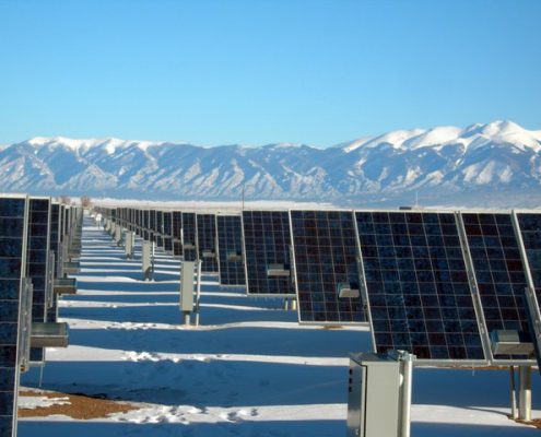
A Look at Solar Energy Land Surveying in 2018

When it comes to solar energy, efficiency and cost-cutting are extraordinarily important. In a world that is increasingly looking toward clean energy, it becomes even more necessary to reduce the costs associated with placing solar panels, in addition to optimizing the panels that are placed. Many of these things can be achieved through better land surveying processes. In 2018, it’s likely that new technologies will be used to further refine the processes of land surveying related to solar energy. In this post, we will explore how solar energy land surveying is likely to change in 2018.

Solar land surveying will leverage technology for faster and safer results

In the past, solar land surveying often had to be completed manually. Either individuals had to conduct surveys on foot (costly and dangerous) or teams had to be sent out to conduct aerial scans (costly). Both of these methods were limited in some way, with manual surveyors being unable to cross treacherous terrain, and aerial scanning often being both expensive and dangerous.

Today, there’s an answer: UAVs can be used to conduct aerial scans without manned teams and without the associated risks. UAVs can conduct solar land surveying quickly, exploring the entirety of the area without any personal risk to the operator. As UAVs can fly lower to the ground than manned vehicles, they can provide higher resolution scans than would otherwise be available.

Not only does this mean that organizations can get their survey information faster, but also that it is more accurate. More accurate results decrease the chances that the solar organization could run into issues later on.

Companies will embark on more thorough scanning for greater profit

As you probably know, solar panel output is significantly impacted by panel positioning. Not only does the arc of the sun need to be considered, but solar panels need to be placed in a way that they won’t interfere with each other, while also taking up minimal amount of space. It’s often unavoidable that some panels will be disrupted throughout the day; ideally, the setup needs to be constructed to take advantage of the most sun possible. This can involve extraordinarily complex calculations.

Moving forward, simulation and imaging programs will be used to analyze the optimal paths for solar panels, so they can use the least amount of land while yielding the best results throughout the day and the year. A tremendous amount of data will need to be analyzed to determine these optimal solutions, which is becoming possible through machine learning and advanced data analytics.

This process will begin with solar surveying, which will give solar companies large amounts of data regarding the terrain. Modern techniques, such as laser scanning, can create complete digital models of an area so a business can place their solar panels with the best possible positioning. This gets rid of much of the trial and error that would otherwise be required.

An increase of accuracy regarding how solar panels are placed can ultimately lead to some substantial improvements in the efficiency and operation of these solar panels. Accurate 3D scans reduce the amount of time it takes to plan and map an area, while even minute changes in placement could yield significant energy results over time.

Further, by fine-tuning and optimizing placement and orientation, companies will be able to make the best use of their land, avoiding excessive and unnecessary land costs.

Looking Forward

Solar energy land surveying in 2018 is going to become a fine-tuned, data-driven process. With the help of UAV/drone technology and better data analytics, solar energy companies will be able to quickly identify the correct placement of their solar panels and install them with confidence. Ultimately, this will produce more energy at a far lower cost to the business, reducing overhead and improving savings related to solar energy.

landpint-UAV-CTA

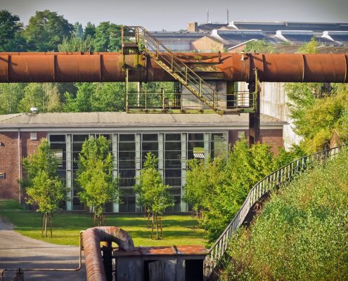
Why Use a UAV for Oil and Gas Facility Inspections?

Oil and gas production, transportation, and processing is a high-stakes, high-risk enterprise. It only takes a single mistake to lead to substantial environmental damage — or human injury. Proactive maintenance and repairs are necessary to reduce these risks, protecting employees, the environment, and the business from harm. In this article, we’ll learn about the numerous benefits of using unmanned aerial vehicles (UAVs) for oil and gas facility inspections.

With UAVs, Inspections Can Be Conducted More Frequently

Conventionally, oil and gas facility inspections have to be done in-person, by an individual or individuals who need to inspect the entirety of the facility. Inspections are done either scheduled or whenever an incident has occurred. This can be prohibitively time-consuming and expensive, forcing oil and gas companies to complete their facility inspections only when required by law.

A major benefit to UAV for oil and gas is that inspections can be conducted more frequently, due to their naturally lower costs. Inspectors do not need to be on-site to use remote devices and they can inspect the entirety of the facility much faster. Faster, more frequent inspections will yield more thorough analysis and results, proactively finding potential issues and resolving them before they can become a safety or environmental hazard.

UAVs Can Respond To Emergencies Quickly

When a leak or spill does occur, it’s imperative that the organization respond quickly to mitigate the damage. Drones can be used to identify and report potential leaks and spills immediately, often able to identify the exact GPS location of the incident. The amount of damage done to the environment often relates directly to how quickly the incident was discovered. Modern UAV’s are also all-weather and can inspect no matter the situation.

UAV Inspections Can Cover Large Facilities Quickly

A UAV for oil and gas can cover a large facility from overhead quickly, rather than having to inspect the area from on the ground. Drones with sensors can “sniff” for potential warning signs, while high-resolution images can be inspected for any potential damage. Since they can go just about anywhere, UAVs ensure that no part of the facility is missed or overlooked, increasing the accuracy and usefulness of facility inspections as they are completed.

UAV Inspections Are Low Risk And Cost-Efficient

UAVs can be used to inspect areas that are potentially hazardous without the risk of injury or loss of life. On-ground inspections may involve environmental hazards, whereas manned aerial craft may experience flight issues and require a large team of staff. Due to this increase in safety and a decrease in necessary personnel, UAV inspections can easily cut costs.

Reducing the risk of damage and environmental hazards will ultimately cost a company much less, both in terms of insurance and damage costs and in terms of public reputation and scrutiny. UAV inspections alone may be able to save an organization a significant amount of money through a reduction in harmful incidents.

UAV Inspections Can Help In Building Customer Faith

There are few things as damaging to an oil and gas company than a poorly handled spill or leak. UAV inspections provide a visible effort that an organization is making towards improving the safety of their employees and the surrounding area. Overall improvements in the oil and gas company’s safety ratings will eventually lead to reduced regulations and more regulatory freedom throughout the industry.

Conclusion

UAV inspections are safe, accessible and cost-effective. Through frequent drone inspections, oil and gas facilities can be kept safer without having to invest in costly or disruptive in-person examinations. Drones provide another layer of safety against potential environmental damage, and they can be integrated with a network of sensors to create an oil and gas facility that can react to its own issues proactively. Through better technology, oil and gas companies will be able to improve the safety of their facilities and focus on optimization and revenue generation.

landpint-UAV-CTA