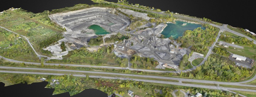
A Look at Landpoint’s Turnkey 3D Surveying Services
3D surveying isn’t just a single process; it’s composed of multiple parts. From initial planning to processing ansd compiling the data, there are several technologies and specializations involved. Finding a 3D survey provider who can complete your 3D surveying end-to-end will provide faster, cheaper, more accurate results.
The Importance of a High-Quality Survey
3D surveying services are used to improve the maintenance of large facilities, survey the land before development, and identify the need for potential repairs or risks across work sites. Understandably, the utility of a 3D survey is only as significant as its accuracy. In order to be beneficial to a project, a 3D survey must be accurate and fast. A slow survey can delay an entire project, while an incorrect survey could eventually lead to costly issues later on. Getting a high-quality survey begins by determining the accuracy requirements of your survey given your current survey budget.
Understanding the Workflow of Your 3D Survey
Once your survey has been completed, the job isn’t done. Your 3D survey data is still going to need to be analyzed, processed, and given to you in a format that you can use. 3D land surveys are used for everything from building and architectural simulations to pipeline site inspection. Depending on your individual needs for a 3D survey, you may need different formats of data or different data provided for your analysis.
Some companies complete all of their survey in-house or end-to-end, while others outsource processing and data storage.
The Benefits of End-to-End 3D Surveying Services
When other services send data out for analysis, they’re relying on other third-party providers for a critical part of their 3D surveying. End-to-end services have the following benefits:
- Fast data capture. As your 3D surveying service doesn’t need to rely upon another provider, they can complete the survey on their own schedule without any potential unanticipated roadblocks. The more parties you involve in your 3D surveying, the more the chances go up that there could be some form of delay or incident.
- Consistent data processing. Your data is being analyzed in-house by a team of specialists who can guarantee that your data is going to be analyzed to the same level of accuracy each time. If you’re running multiple projects, you need to have similar and reproducible results if you want to plan ahead.
- Complete data access. A turnkey surveying service is able to house and store your data as well, letting you access your data from anywhere via a hosted service. This is particularly important if you are viewing remote sites or if multiple parties need access to your survey data.
- Reduced costs. Every time multiple parties are involved in a survey, the costs go up, as services need to be negotiated on a granular basis. End-to-end surveying services provide everything you need in a single, cost-effective turnkey package, and there won’t be any unexpected costs added on.
- Improved service and security. As you’re only working with a single company, you only have a single point-of-contact. They will be able to update you continually on the progress of your project and will be able to let you know immediately when the project is done.
Through an end-to-end 3D surveying process, you’ll be more likely to get guaranteed, fast, and cost-effective results. Outsourced services may be unpredictable, unsafe, or just less than accurate. When it comes to data that your project requires for current and on-going success, being able to rely upon a single provider is often preferred. Landpoint offers complete end-to-end drone-powered 3D surveying services with a 24-hour turn-around and survey grade accuracy.


