Professional Land Surveyors Helping Reduce the Risk of Drilling Dry Wells
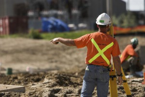
Oil and Gas ProjectsGIS technology is critical when mapping well sites for drilling operations. The cost of drilling a dry well can quickly eat into an operation’s budget. However, a professional land surveyor can use GIS mapping to leverage central geological and physical datasets to help analyze, summarize, and make determinations more effective planning.

Finding the Right Location

Geologists typically analyze the prospective well drilling area by checking rock and soils types, land terrain, as well as the gravitational and magnetic area fields. Geologists perform seismic surveys and test for hydrocarbons in and around the site. Seismic surveys are not fool proof as they may find what appears to be an excellent reserve trap but which may turn out to be dry when drilled. Dry holes are the lack of charging or breaching of previously charged reservoirs where the hydrocarbons have escaped. Geochemical soil gas surveys used in conjunction with seismic surveys can significantly improve successful hydrocarbon exploration ratios and reduce “dry hole” risk.

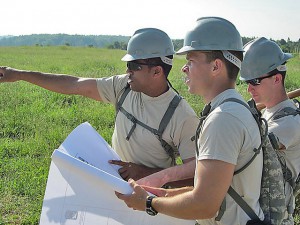
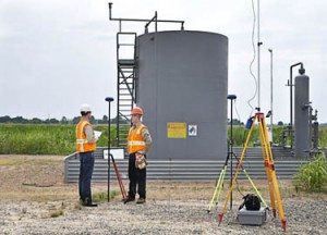
Once geologists select the prospective well drilling location, surveyors are called to stake the well site. It is the job of professional land surveyors to prepare 2D and 3D mappings. A plat map, stamped and signed by one of the licensed land surveyors, showing the staked well location is required by various states prior to drilling. This provides insurance of the correct location, to the best of the geologist and land surveyor’s knowledge. Erroneous information may result in the drilling company losing the ability to hydraulically fracture all segments of the downhole well lateral, or encounter a dry well. It is not uncommon for a well to be relocated several times on the surface before drilling. Accurate documentation is vital.

Prior to Drilling

The drilling site must be prepared and free from hazards. The professional land surveyors should conduct a line location survey in preparation to level the drill site as well as for the excavation of the reserve and settling pits. Access roads and the drill pad must be staked and prepared prior to commencing drilling operations.

Cost and Consequences of Dry Drilling

Drilling risks may be moderate to high depending on the proximity of drilling to existing producing wells. Wildcat or high risk drilling occurs greater than 1.5 miles from the nearest producing oil well or 3 miles from the nearest producing gas well. Conversely, low risk, developmental drilling operations, are within half a mile of oil or within one mile of gas wells already drilled and producing. Geochemistry is not as critical, but is useful in determining where blind compartments of stratigraphic traps lie. Outpost drilling offers moderate risk. Drilling is located within 0.5 – 1.5 miles of the nearest producing oil well or 1-3 miles to the nearest active gas well. Geochemistry is a cost efficient means of locating the extreme limits of newly-discovered fields.

When GIS tools are not used during analysis, dry drilling can occur. Dry drilling is loss of circulation and fluid. Although the well is bored, the fluid does not rise to the top. Operation losses may be as little as a broken drill bit or as major as a damaged wellbore, drill string, snapped pipe, or damaged rig. In terms of barrels per day and revenue, a “minor loss” is considered to upto 470 barrels in a 48 hour period. Severe losses exceed 470 barrels or occur when fluid gushes to the surface and is wasted or lost.

To learn more about how experienced professional land surveyors can help with oil and gas projects, download our free ebook about modern land surveying technologies.

Top North American Large Infrastructure Projects to Watch

Land SurveyingAs the world’s population rises, so too does the need for additional infrastructure. This has led to a greater number of large infrastructure projects, which in turn has led to a greater need for land surveying and engineering services. These projects range from roads and highways to oil and gas pipelines and other energy related structures. When completed, many of these projects will have a huge impact not just on the local communities but in some cases all of North America and even the world.

While there are a number of impressive infrastructure projects, these are some of the most current and exciting projects that are either underway or close to being started:

  • The $6.2 billion Dulles Transit Extension in Washington, D.C. started in 2008 is the largest Metro system expansion in the city’s history. Mostly above-ground public transportation, it will provide access from Downtown D.C. to Dulles Airport and North Virginia suburbs. One intent is to reduce traffic congestion on the Beltway.
  • The $746 million Lone Star Transmission Competitive Renewable Energy Zone 345-KV Electric Transmission Line is Texas’ largest single transmission project. It consists of 320 miles of new lines. Six hundred seventy-one parcels are crossed by the new lines. Three 345kV substations and two compensation stations are part of the construction. Ten million dollars in property tax revenue will be generated in the first operation year.
  • The estimated $2.5 billion Crescent Corridor Expansion is an aggressive series of freight rail projects running from New Orleans to New Jersey through thirteen states. Intermodal terminals and approximately 300 miles of track is planned. Freight companies desire cost savings while achieving the removal of interstate congestion and pollution. The upgrade depends on public funding, and is tentatively scheduled for completion by 2030.
  • The $3.1 billion Alaskan Way Viaduct project is intended to strengthen Seattle’s iconic double-decker, elevated highway that runs through downtown, adjacent to the Puget Sound. A 2001 earthquake damaged an already weakened structure. Replacing the viaduct is more cost-effective than repairing it. Initial debate about replacing the elevated roadway with a tunnel delayed the project. The tunnel will create more open space along the waterfront and the south portion of roadway will be rebuilt. Both structures are designed to withstand a 9.0 earthquake. The 2015 completion date may be delayed however, due to the immense tunnel boring machine breaking down and sitting inactive for months.
  • Although no longer a US territory, the 99-year old Panama Canal is currently undergoing a $5.25 billion expansion. Three 1,400-foot long by 180-foot wide by 60-foot deep locks will be added to each end and the Atlantic end will be dredged. Strict environmental and reforestation phases are part of the project. The upgrade that will accommodate larger container vessels is hailed by the largest global shipping companies. Begun in 2007, the Canal Expansion Program has become a major trainer and employer of land surveyors, engineers, inspectors, and others.
  • The $5.3-billion Alberta, Canada to Nebraska Keystone XL oil pipeline has been a political issue for many years. The project that potentially provides the US decades of fuel, extends the existing Keystone pipeline carrying Canadian crude oil and diluted bitumen to Nebraska and Illinois to continue to other Midwest and Texas Gulf refineries and saltwater ports. The Contractor says the pipeline is the safest ever built. Environmentalists and alternative energy advocates are not convinced and there have been spill prevention, leakage, and potable water concerns among communities along the route.

For more information about land surveying for large infrastructure projects, please feel free to contact us. Landpoint has extensive experience with various infrastructure projects, especially when it comes to oil and gas.

Image by : Khunaspix

Construction Project Planning Tips for Managing Multiple Survey Teams

Land SurveyorsA survey assignment’s complexity depends on the type of surveys needed, the time required to complete the field work, and the office time it takes to process the data and generate maps and plans. It’s not uncommon on large projects to utilize several different land surveying teams.

When the job calls for more than one survey team, the land surveyor’s primary intent is to efficiently collect all necessary data. The challenge, however, is to effectively plan, coordinate, and manage these teams in such a way to avoid mis communications and task redundancy, overlap, and need to re-survey. This post provides a number of construction project planning tips in order to help managers seamlessly oversee these multiple teams.

Managing Multiple Land Survey Teams

Land surveying firms offer a variety of services. For any major project there is a need for:

  • Pre-construction planning
  • Amendments and changes
  • Construction
  • Post-construction

Within any project phase there are needs to simultaneously provide layout, staking and control services:

  • Permits– Accesses, drainage and pipeline crossings, river and stream diversions, relocations.
  • Environment Concerns– Pre-construction and construction delineation and mitigation.
  • Site Design / Earthwork – Boundary lines and plats, well pads, staging, building, production.
  • Layout And Control – Grade, pipe and pipeline bridges, structure and equipment foundations
  • Geotech Data – Borrow sites, volume calculations, bearing capacity, slope stability
  • Post Construction – As-builts, claims.

Criteria for Survey Team Management

Utilization of the latest land surveying technologies and current software is important to efficiency. Land surveyor teams with better tools are more flexible, mobile, and scalable. The land surveying manager then is not as concerned with equipment reliability, availability, and accuracy, and can focus on deploying teams that can fully execute their assignment in a timely manner.

There are three basic things that can be done in order to effectively coordinate multiple survey teams and help ensure survey assignments are completed on time and within budget:

1. Utilize Land Surveyors Experienced In Working Together And/or Familiar With The Particular Region.

When teams have experience working together, there is usually better communication. This communication is especially helpful if at least one of the teams has experience working in the region that is being surveyed, as they can provide better insight into how to go about the survey.

Land surveying teams are comprised of a party chief/lead, and technicians knowledgeable in the specialty (utility, right of way, seismic, geotechnical, and environmental, boundaries) that the particular assignment requires. Familiarity with the region, landmarks, markers, and unique obstacles such as streams, rivers, rugged terrain and total open space help reduce the potential for unpreparedness and unnecessary complications. These issues can include un-calibrated equipment, poor field organization, slow decision making and problem solving delays. It is also not uncommon to find a survey team lost enroute to a remote jobsite. When at least one team is experienced working in a particular region, they are able to communicate and wok through the challenges.

2. Establish Criteria for Plats at the Start of a Project

Preliminary plats are used as a starting point for most projects. They are considered comprehensive tools and may be changed during the course of the project. They should contain significant information to lay out the proposed project. Plat maps should show:

  • As-built geological data and legal descriptions
  • Identified boundaries, floodplains, drainage courses, road accesses, easement, right of way
  • Past and proposed site development
  • Underground as well as above-ground structures
  • Ownership, occupancy, legal rights, third-party rights, claims, and liens

However, different surveying teams may use different criteria for each of the plats that they create. This can create confusion and miscommunication when information needs to be compared between plats from two different teams. If you are bringing in multiple survey teams, make sure to establish the criteria for the plats early on to prevent this confusion.

3. Utilize a Project Management System

A project management system is invaluable to construction project planning. A project management system allows different survey teams to easily share information on a single platform and collaborate effectively with the client. This improves communication between teams and creates a single depository of information for them to put upload data to. This greatly increases the speed from which the multiple teams work and makes it less likely to have discrepancies between data collected between the two different teams.

For more information on construction project planning for oil and gas companies, download our free eBook on the latest land surveying technologies and how they benefit oil and gas projects.

Image By : Georgia National Guard

Why Scalability is Key to Oil & Gas Surveying

land surveying projectsScalability is the ability to quickly adjust to changing conditions as they occur. Projects need to continue even when new information changes the nature of the operation and demands an increase in scope. When it comes to oil and gas projects, land surveyors must meet deadlines, manage change, and ensure the end result meets company needs and regulatory standards.

As oil and gas industry operations expand, land surveying scalability becomes a major challenge. Many surveying companies are small and unable to scale, while others may not be able to scale quickly enough to accommodate oil and gas companies’ needs. As a result, companies may experience much longer turnaround times. “Time is money,” and increased survey turnaround is inefficient and costly.

It is extremely beneficial when land surveying firms can efficiently and effectively provide accurate oil and gas field data to aid engineers in decision making and problem resolution. Land surveyors may be required to change course quickly. Regardless of conditions and obstacles, oil and gas surveying projects must meet deadlines and milestones. To do so, they need the team and the technology to be able to easily handle project changes as well as the ability to properly manage resources once they are in place.

Land Surveying Projects & Scalable Technologies

Most oil and gas surveying projects are multi-phased, from field data collection, to surveyors review, to client deliverable distribution. Oil and gas surveys tend to become more complex as the project progresses. An original survey may turn into re-rotes, moves, and overall scope increases, requiring more resources and in many cases additional skill sets. The survey firm should have the capacity and resources to be able to add additional crews and equipment as needed.

Having access to some of the latest surveying technologies enhances scalability. For example, the best GIS uses significantly more data and keeps all of the information in the cloud. Data is made available through smartphones and tablets, enhancing communication between teams and keeping everyone in the loop. When information is kept in a central location and made easily available to those in the field, it means that no matter how many new teams are added, everyone will still be on the same page.

Some important methods, programs, and project management features indicating a surveying company is focused on continued scalability are:

  • Advanced GNSS
  • 3D scanning applications
  • Mobility / mobile devices
  • A real-time, in-house project management system
  • Knowledge of oil and gas companies’ multiple land leases and operations
  • A large pool of readily-available on-call survey teams
  • A reputation for updating and incorporating the latest technologies
  • Professionals that are knowledgeable of the most current land survey technologies

The Benefits of Scalable Oil and Gas Surveying

Ultimately, partnering with a firm that can easily scale helps your oil and gas project with three critical elements:

  1. Speed – By being able to add additional resources as soon as they are needed, a scalable land surveying company can vastly reduce the time needed to complete a project.
  2. Accuracy – A land surveying company needs to have a broad skill set and experience in a number of different oil and gas surveying related disciplines in order to take on the additional tasks that may come up in a project. If they do not have these things, they may attempt to take on tasks with mixed results.
  3. Efficiency – The more a project expands and changes, the more necessary it is that the surveying company be able to communicate with other teams and share information.

It is better for an oil and gas company to pick a land surveying company that can scale right from the start, instead of having to change midway when it becomes clear that the current surveying company cant. For more information, take a look at our oil and gas brochure.

Landpoint Acquires Two Other Land Surveying Companies, Awarded “Deal of the Year”

Oil and Gas ProjectsLandpoint scored big at the annual D CEO/ACG Mergers & Acquisitions Awards event held May 6 in Dallas, winning the award for “Deal of the Year” in its category.  The award was based on the Landpoint’s recent acquisition of two other land surveying companies: West Company of Midland, LLC. in Midland, Texas and the Fort Collins, Colorado based King Surveyors, LLC., last year.

The company’s deals topped competitors in the category of similar transactions, worth up to $50 million. The company now has more than 220 employees and nine office locations in five states – including its new Midland, Texas regional office with a primary focus on oil & natural gas infrastructure development.

“We are honored to have caught the attention of D CEO and ACG’s Mergers & Acquisitions Awards panel,” said company Vice President Chad Souter. “We were very confident in our initial strategy and it’s exciting to receive recognition from leaders in the M&A industry.”

Landpoint’s strategy included diversifying its client base and geographical exposure through acquisitions that paralleled the organic growth strategy of the company. Landpoint has become a platform for future acquisitions and has automated many processes for integration and development plans. The combined land surveying companies of Landpoint, King Surveyors, and West Company of Midland now hold a significant market share for top production and midstream companies throughout the Eagle Ford and Permian Basin, as well as the Niobrara and Haynesville shale plays.

The awards, presented by D CEO and the Association for Corporate Growth, highlighted four different categories: small, midsize, large and mega deals, as well as a handful of dealmakers for businesses in the North Texas region. The North Texas economy and growth of mergers and acquisitions has come back strong in recent years. The awards focused on 38 deals with a total of $45.7 billion for 2013.

Pre-Construction Planning Process: How Land Surveying Services Help

ID-100208177A construction survey typically consists of determining current site conditions for future above-ground and in-ground infrastructure. Land surveyors stake elevations for footings, collect topographic data for mapping existing drainage courses, invert elevations and diameters of pipe and manholes perform a number of other services. Land surveying services are used to establish the accurate location of proposed structures, accesses, pipelines, buildings, and other improvements.

Most land surveying services are provided by local companies or companies with local offices. They typically have some prior knowledge of the area to be surveyed, including its history, soil& water conditions, sensitive areas, habitats and protected species. This not only reduces the time to get to the designated site, but also provides the client valuable area insight upfront, from which decisions may be made and plans designed.

Land surveying services can include due diligence as well. Land survey teams may inspect buildings for hazardous materials such as asbestos, lead, and PCBs, which must be addressed prior to demolition, new construction or exploratory operations. Land surveyors may also discover other issues such as buried fuel tanks or ground water contaminants.

How Land Surveying Services Help With Pre-Construction Project Planning

A surveying firm adds more value to the pre-construction planning stages of any project. In addition to site analysis, boundary & topographic surveys, maps, and plats, they also:

  • Help mitigate the risk of potential future regulatory enforcement actions
  • Minimize or eliminate costly delays in project schedules
  • Maximize project startup efficiencies through comprehensive regulatory planning
  • Provide data which helps define project scope and aids strategic pre-construction planning
3D Scanning for Retrofits

Retrofitting involves modifying existing structures or equipment to reinforce and add structural life to it. Many existing buildings, overpasses, bridges, and towers are being retrofitted to withstand potential seismic shaking and shocks.

Surveying teams collect data which is used to construct a 3D model of the existing environmental features, structures, and objects. 3D scanning is ideal for analyzing, planning, and designing retrofit projects. The surveying team collects its data points in the field and creates a digital model that depicts height, width, and depth.

3D maps and point clouds show elements and measurements of buildings, utilities, construction and structural objects such as pipe, cable, and plumbing. This is very helpful when an existing building or structure (such as a bridge) is scheduled for retrofitting. Engineering departments find these deliverables invaluable when working on retrofit projects.

Establishing Survey Standards

For any given project there may be more than one surveying company involved. One surveying firm may well establish basic standards in the pre-planning phase for other surveying teams to follow. A responsible and reputable surveying company may set the standard for work production and quality, safety, schedule, and deliverables. This indirect competition and expectation tends to escalate project progress. Additionally, established standards clarify expectations which contribute to enhanced quality control.

GIS and BIM (Building Information Modeling) Software Tools

Land and air surveys provide data to build models and 3D mapping. GIS (Geographic Information System) software aids in large scale planning. Data collected may be analyzed and processed. GIS applications may be used to assist project pre-planning in areas of:

  • Resource management
  • Utility management
  • Infrastructure management
  • Environmental impact studies and land management
  • Leased land, land use, zoning, and boundaries
  • Plats and development
  • Legal descriptions and measurements
  • Market and statistical analyses

BIM (Building Information Modeling) is another software decision making tool that assists in planning physical features and infrastructure such as water, gas, communication, power lines, buildings, and roads. BIM expands 3D modeling. It includes concepts of time and cost in addition to height, width, and depth. Component quantities and spatial relationships are integrated into the process. BIM extends through the project lifecycle, far beyond the pre-construction planning process. The BIM program supports:

  • Construction management
  • Project management
  • Facilities management
  • Cost management

For more information on GIS, BIM, and pre-construction planning offerings, please take a look at our brochure.

Image By : Stockimages

Oil and Gas Projects: Finding a Safety-Focused Partner

pipeline land surveyingIn accordance with OSHA (Occupational Safety and Health Association), every worker has a right to a safe work environment. This is especially important for those in the oil and gas industry for the company as well as for their consultants and partners.

Oil and gas project safety has to be everyone’s priority regardless of job assignment, office or field. Vehicle accidents, explosions, fires, chemical exposures, confined space hazards, or employees caught in equipment may occur on rigs, in wells, or along pipelines. And, hazards that cause people to fall, trip or slip are a threat in any workplace environment.

Safety on Oil and Gas Projects: The Most Common Violations

OSHA’s General Industry Standards (29 CFR 1910), OSHA’s Construction Standards (29 CFR 1926), and General Duty Clause of the Occupational Safety and Health (OSH) Act were enacted to protect worker health and safety in the oil and gas industry.

According to OSHA oil and gas surveys, the five most-cited violations are:

  1. Hazard Communication (HazCOM) – Negligence of OSHA requirements to provide material safety data sheets (MSDS) for all hazardous materials and chemicals, posted notifications of hazards and chemicals present, or employee training (regular safety meetings).
  2. Permitted confined spaces – Safety violations occurring in spaces with limited egress and those over 4-feet deep, including manholes, mineshafts, airshafts, wells, crawl spaces, etc.
  3. General Duty Clause (Section of the OSHA Act) – Failure of the employer to comply with OSHA standards or provide a workplace/jobsite free from recognized safety hazards that might cause death or serious physical harm to employees or employee(s) failure to comply with OSHA standards through acts and actions (including drug and alcohol abuses).
  4. PPE (Personal Protective Equipment) – Failure to comply with the OSHA requirement to provide and wear gloves, coveralls, respirators, protective head gear, safety reflective vests, ear, eye, and face protections.
  5. Wiring, Components, and Equipment – Failure to control gases under pressure that might ignite, cutting and welding near flammable or explosive materials, or poorly maintained electrical wiring or equipment.

Setting Safety Standards on Oil and Gas Projects

Studies indicate that employees who are injured are typically:

  • Male
  • Age 25-34
  • Employed less than one year
  • Struck by an object (related to parts or materials)
  • Experienced a strain or sprain to their arms, wrist, hands, or fingers
  • Off work for 31 or more days

It is important for the company to set high standards for safety early on in a project. This pertains to the employer, workplace/jobsite, employees and their behaviors that might indirectly create a hazardous environment (negligence, intoxication, addiction, anger/violence, etc.).

Explosions, oil fires, chemical spills, collapses, cave-ins, and confined space Oxygen deprivation require employee training in proper mitigation and PPE use, emergency response, site securing, and recovery operations. HazCOM enforces employees’ rights to know potential hazards, how to avoid them, and what to do in the event one occurs. Teamwork and support are equally important.

Oil and Gas Project Safety Concerns: Selecting Partners

Responsibility for safety extends to companies the oil and gas company chooses to partner with. Criteria to determine if a firm (survey, engineering, construction team) is credible, responsible, and safe include:

  • Flexibility – Is the partner willing to accept the oil and gas company’s established safety guidelines?
  • Experience/ Accreditation – Does the partner have knowledge, experience, accreditation, and a clean workplace accident record? (Generally, experienced and accredited firms tend to be “safer”).
  • Ability To Identify Potential Dangers – Is the partner cognizant of conditions that could be hazardous? (Survey Partners using GIS, for example, may identify and mitigate potential safety concerns early in the project).

The partner may additionally be evaluated based on the following desirable qualifications:

  • ISNetworld, PEC/Premier, and PICS compliant in all areas of operation
  • Demonstrated enforcement of NCMS DOT drug and alcohol compliance for personnel
  • Active personnel health and safety program including regular safety meetings

On the job site, safety and accurate end results are of paramount importance. Landpoint is 100% ISNetworld, PEC/Premier, and PICS compliant in all areas and enforces NCMS DOT drug and alcohol standards. We invite you to contact us to learn more about what we can do for your oil and gas project.

Image By : SweetCrisis

How Cloud Computing is Revolutionizing Oil and Gas Projects

cloud computingCost cutting and improved efficiency are central to oil and gas companies. Changes in the industry, new regulations, and increased competition have companies looking at technology differently than they did even five years ago. In particular, cloud computing is revolutionizing the oil and gas industry, particularly in areas of oil and gas surveying and project management.

Cloud computing platforms can be somewhat invisible. Because they are so simple to use and make previously complicated tasks easy, it is entirely possible that the user may not realize just how much this technology is impacting their business.

The Value of Cloud Computing to the Oil and Gas Industry

Cloud computing, in general terms, is the ability to simultaneously distribute information over a computer communication network to many users. The flip side to this is the ability to access and retrievethe vast amounts of stored dataregardless of time and location.

Cloud computing is extremely popular in industry and business for the same reasons any innovation or technology is popular: improved efficiency and cost effectiveness.

This is especially useful for the oil and gas industry, which has to handle large amounts of data as well as manage multiple, often remote teams. With any oil and gas project there are a lot of moving parts, and cloud computing can be used to make these parts work more seamlessly with one another. Important data and documents can be easily accessed by those partners who are cleared to view them. Since information is available onany internet capable device, data can be uploaded from a project site and made instantly available back at regional centers or corporate headquarters.

Land Surveying and GIS Mapping via the Cloud

Quality control, connectivity, and real-time survey and drilling data are enhanced through cloud computing. Mobile devices are already used by oil land surveyors to collect data and upload it to servers. Seismic crews use wireless recording stations to ensure quality control.

Data can be collected from the field and immediately uploaded. Land surveyors collect data and cartographers in an office in the next state can interpret and map it for immediate uploading and distribution. Stored map information may be integrated into other internal systems, or used on-site by the project manager and crews.

Oil and Gas Data Management: Now in the Cloud

Project managers utilize cloud technology to query and view cross-project and multiple task data files. Historical, geological, and drilling operations data relevant to the project they are working on, can be accessed by simply logging into the cloud repository.

Using cloud technology for Oil and gas data management also makes it easy for the project manager to share pertinent information with all project stakeholders. Additionally, data can be easily cross analyzed and interpreted, leading to decisions being made and conveyed faster, thus reducing adverse impacts to the community, company, and environment. This efficiency also translates into minimization of costs associated with delays, slowdowns, catastrophes, or other unplanned interruptions.

Using cloud data also provides project managers with additional information to effectively determine critical milestones, create achievable schedules, and generate more complete reports and more informed budgets.

The cloud provides a continuous and secure flow of information from a variety of cross-disciplined experts. When oil and gas companies implement a cloud computing platform, they will see much more reliable service results while saving money at the same time.

If you are looking to use cloud technology to cut costs and increase efficiency, then try our Oil & Gas Data Management Demo for free and see what a difference it can make.

Image By : SweetCrisis

5 Challenges Oil and Gas Companies Are Facing in the Eagle Ford Shale

Oil and Gas Companies Eagle Ford ShaleDomestic shale extraction of oil and natural gas has created a substantial economic boom for the country. Oil and gas companies working the Eagle Ford Shale area of Texas are generating wealth and jobs, but financial, human-resource and technology challenges persist. Nearly 400 drilling rigs operate in West Texas, and Eagle Ford Shale contains 3.351 billion barrels of oil and 20.81 trillion cubic feet of natural gas. The area generates more than one million barrels of oil and nearly 5,000 cubic feet of gas per day. Oil production in 2013 topped 688,429 barrels. Shale extraction at Eagle Ford has generated an unparalleled economic windfall for localities, Texas and the nation. Prospects for continued increases in production are astonishing.But there are still a number of challenges that oil and gas companies are facing in that region. Here is a look at 5 main issues they are facing.

Problems that Technology and Regulation Must Solve


Challenge 1—Skilled Labor Shortages

Drillers, truck drivers and skilled workers are increasingly hard to find. Eagle Ford Shale gas and oil companies employed 38,000 workers in 2011, and demand is steadily growing. The 14 surrounding counties have sparse populations, and transient workers create hosts of service problems for localities.

Challenge 2—Failure to Invest in New Technologies

New technologies drive efforts to revisit old fields and extract oil and gas. Failing to invest in technology, pipelines and other energy-delivery systems could cause production companies to miss potential revenue generating operations. Stakeholders in raising funds for research include drillers, landowners, major energy users, utility companies and regulators at all levels of government. Technology challenges include finding better methods of detecting methane leaks, optimizing production, cutting costs and minimizing environmental damage.

Challenge 3—Ensuring Safety and Security

For oil and gas companies, safety and security issues are interrelated to all the other challenges of shale extraction. Drillers, landowners and residents face the following risks:

Proximity to Mexico

Mexican drug cartels smuggle drugs, people and contraband across the border.

Inexperienced Workers

Scarce labor causes companies to hire inexperienced people to work in hazardous environments where mistakes could cause major risks.

Poor Records

Poor record-keeping results in mistakes, inefficient field data collection and faulty security reviews.

Oil and gas companies concerned with security also need to make sure that they partner with contractors who put strong emphasis on safety. If safety isn’t a top priority for everyone involved with a project then it can easily result in a hazardous work environment.

Challenge 4—Protecting the Environment

Water use and conservation are big issues in Texas, and overlapping and contradictory regulatory requirements create challenges at the federal, state and local level. Texas has the unique distinction of supporting environmentalism and big energy. Environmental challenges that oil and gas companies face in Eagle Ford Shale include:

Water Shortages

Texas suffers from ongoing water shortages, and fracking shale requires vast amounts of water.

Air emissions

Perhaps the most well known oil and gas environmental regulation. Dealing with problems of air emissions include those generated by drilling and air emissions by large fleets of tanker trucks. Diesel rigs produce fumes and drilling releases volatile organic compounds, methane and greenhouse gases.

Challenge 5—Transportation

While it’s possible to transport oil and gas by rail or by truck, these methods tend to be costlier. The most efficient and inexpensive method is by pipeline, although this comes with its own set of challenges:

Property Rights and Landowners

As local landowners become more educated about their rights there has been a rise in cases regarding right-of-ways, shut-in-wells, lease terms, and other legal issues. This makes running pipelines through their property more challenging and requires a greater degree of field data collection and planning beforehand in order to ensure that a clear legal picture is made during the initial surveying work.

Line Capacity

In some areas of the Eagle Ford Shale, the current amount of pipelines is at capacity and in some cases wells have been shut in. As a result, there has been a drive to build new lines and expand existing ones in order to increase capacity.

The Bottom Line

Oil and gas companies provide 62 percent of energy consumption in the United States. The energy industry must deal with technology changes as well as environmental and regulatory challenges and conflicting agendas from stakeholders. Advanced field data collection and 3-D modeling has helped to reduce costs as well as keep projects organized and running on time. What are the challenges that concern you the most? What are the best ways of tackling these issues? Please post your thoughts in the comments below.

landpoint