GIS Consulting Services for Intelligent Transportation Systems
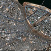
 GIS consulting services provide critical assistance for planning, maintaining, evaluating and managing the infrastructure of transportation systems around the globe. Intelligent transportation systems are based on the results of GIS consulting, enabling decision makers to prioritize their work and make the best choices. With GIS mapping technology, you can build rich, dynamic and detailed mapping applications that will guide your project from start to finish.
How GIS Consulting Services Help At Every Stage of Development
Transportation planning projects stem from a lifecycle that starts with the planning stage and includes design, environmental management, asset and maintenance management, construction, operations, safety, security management and more. GIS mapping is an essential element of each step in this process, producing tools like as-built drawings, multi-layered data maps and more. The performance of a transportation system and the productivity of employees both increase when these GIS tools are utilized.
During the initial planning stage, GIS mapping helps transportation pros analyze their projects in regard to a variety of factors, including environmental, land-use and energy consumption factors. GIS mapping brings all these factors together in one easy-to-use medium.
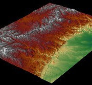
GIS consulting during the design stage benefits engineers by producing detailed imagery, elevation models and critical environmental information. Design and financial software can easily be integrated into a GIS, making construction cost estimations simpler.
One of the most important applications of GIS mapping during the planning of transportation systems is environmental management. Through GIS maps, project planners can better understand environmental issues, determine eco-friendly solutions and identify the impact of their decisions on the environment. Growth issues are addressed through integrated information regarding land-use, employment density, housing and other factors. This information helps planners make better decisions regarding environmentally-sensitive matters. Having a detailed design plan displayed within GIS allows the engineers and planners see the effect every option will have on the land and economy surrounding the project before even breaking ground.
These are just a few of the ways Landpoint’s GIS consulting services and GIS mapping services can improve your transportation projects. Learn more about how GIS mapping can help you through every stage of the process by contacting us today!
Image By – edibleoffice


