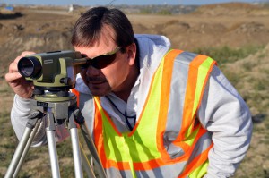
How Important is Technology When It Comes to Finding An Accurate Land Surveyor?
 If you’re in the later phases of planning your development project, then perhaps you’ve already heard about the potential benefits that working with a land surveying company can offer. But just what are those benefits and where do they come from? In this post, we’ll examine how working with an accurate land surveyor that offers the latest land surveying technologies can benefit your surveying project from start to finish.
While the benefits of advanced surveying technology are diverse and many, they can essentially be broken down into four main points:
- Faster surveys
- More accurate surveys
- Less expensive surveys
- Safer surveys
Faster Surveys
The more time you spend conducting land surveys, the further you delay the process of actually completing your development project. As a result, generating surveys as quickly as possible is a worthy goal, one that new land surveying technologies can help oil and gas companies achieve.
One example of a technology that supports faster surveys is unmanned aerial vehicles (UAVs), which are commonly known as drones. UAVs are able to help with mapping and scanning from above, allowing them to cover large areas in a relatively short period of time. In addition, since they do not have to travel over land like traditional land surveyors, they are generally not slowed down by difficult terrain. Finally, the data gathered by UAVs can be sent to a cloud project management platform, so that engineers can instantly begin putting that data into action.
More Accurate Surveys
Completing accurate surveys is important because land surveys form the foundation for everything else that comes later in the design and construction phases. If the foundation is not sound, it can lead to inconvenient surprises and unexpected costs later on.
An accurate land surveyor will know will almost always use 3D laser scanning technology. By bouncing millions of points of light off of a building or terrain, 3D laser scanners can quickly put together a data point cloud that can then be used to build a very detailed model of the building or terrain that was scanned. Today’s high-definition laser scanning technology has developed to the point where it can create models to within four millimeters of accuracy.
Less Expensive Surveys
High costs for land surveying can usually be traced back to time-consuming manual processes. As mentioned before, when land surveyors have to cross terrain overland to conduct their work, it is very time consuming, which in turn leads to higher costs.
An accurate land surveyor that utilizes the latest technologies can cut down on the costs of surveying. UAVs are helpful because they allow surveys to be completed quicker with less manual work for surveyors to do. In addition, 3D modeling can be used to create construction plans quickly, which also helps keep costs down.
Safer Surveys
Last but certainly not least, advanced surveying technologies can help keep surveyors and other employees safe, which should be the single most important goal of any construction project. With surveying, the biggest risk comes from rugged terrain, which is not easy to traverse and requires much more caution on the surveyor’s part. Because more caution is needed, the survey can take longer to produce.
Technologies such as UAVs remove the need for land surveyors to physically travel over difficult terrain. This eliminates the risk of harm coming to the surveyor while at the same time producing a detailed survey.
To learn more about the benefits of advanced surveying technology for land surveying projects, contact Landpoint today.
Image Source: U.S. Army Corps


