How Municipalities Can Reduce Costs by Using Land Surveying Services
 Municipal government agencies face a variety of challenges when it comes to major building projects. Their projects must meet the same standards for quality and safety that every other building project is held to, but at the same time, they must also make the most of taxpayer funding.
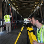
One way that municipal agencies can cut costs for their building projects without negatively impacting results is by taking advantage of new technologies. Specifically, new land surveying technologies such as 3D laser scanning and unmanned aerial vehicles can make it significantly less expensive to gather needed data, allowing an agency to save money before the project even breaks ground.
In this post, we’ll take a quick look at these new technologies and talk about how these land surveying services can be beneficial to municipal governments.
3D Laser Scanning
3D laser scanning, also known as LiDAR, is a technology that can be used to quickly gather land surveying data to support the creation of very detailed models and survey documents.
The technology works by setting up a series of laser scanners around the building or terrain that is to be scanned. Then, the scanners emit thousands of laser points, which bounce off the object being scanned. The scanners track the flight path and trajectory of the laser points as they return. Finally, the scanners assemble the data from all the various laser points into a single data cloud, which can in turn be used to form 3D models and land survey documents.
The cost savings aspect of the technology can be traced back to the fact that laser scanning can be performed quickly, requiring a small fraction of the man hours that go into traditional land surveying methods. In addition, the extremely detailed models created with the data gathered from laser scanning helps a project get off to the right start and removes the potential for expensive delays and rework once the project has already started.
Unmanned Aerial Vehicles
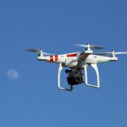
Unmanned aerial vehicles (UAVs), also known as drones, are another example of a new technology that is helping to make the land surveying process cheaper, faster, and more accurate.
UAVs can be fitted with relatively inexpensive high-definition cameras to capture very detailed images from above. While traditional land surveyors would have to travel over land to complete their work, often crossing unsafe terrain in the process, UAVs are able to travel direct routes, significantly reducing the amount of time they have to spend gathering data.
Unlike manned aerial vehicles, UAVs are able to get very close to the ground or the structure being surveyed and have no difficulty getting into and out of tight spaces.
Using UAVs for land surveying projects costs a small fraction of traditional land surveying methods because they are able to cover large areas in a relatively short period of time—as much as 400 acres in a single hour, in fact. In addition, most of the processes involved with UAV data capture are now completely automated, significantly cutting down on the amount of time a team has to spend on the data gathering effort. Finally, the data captured using UAVs can be ready for use in as little as a few hours, with a 24 hour turnaround at the maximum. This helps engineers make better use of their valuable time by cutting down the time they have to wait to get the data they need to do their jobs.
If you’re ready to make the most of the taxpayer funding for your municipal project, while also ensuring a land survey that is highly accurate and quick to produce, Landpoint is here to help. Contact us today to learn more about our land surveying services.
Image source: CDC Global


