Posts

How Oil and Gas Surveying Will Change in 2015
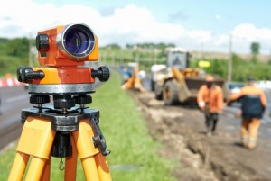
Oil and Gas SurveyingIn the early days of 2015, the oil and gas industry finds itself at a crossroads: external forces are in play, creating a situation where companies have to get accurate, detailed land surveys quickly, without having to pay too much for them. Those companies that can ensure the most affordability and value possible from their oil and gas surveying will be the ones that are in the best position to succeed in 2015 and beyond.

In this post, we’re going to take a look at the future of oil and gas industry and provide a quick overview of some of the ways that land surveying is changing the industry in 2015.

Three ways that oil and gas surveying will change in 2015

1. The surveying technology that companies use will grow more sophisticated.

Whenever an industry faces new challenges, there will always be new technologies available to help companies overcome those challenges. This is certainly true of the future of the oil and gas industry. In order to meet their needs for faster, more accurate land surveys at the most affordable rate possible, today’s oil and gas companies have a number of increasingly sophisticated tools in their toolbox. These include things like cloud-based systems for better communication, collaboration, and storage, advanced handheld devices to facilitate better connections between home offices and job sites, and unmanned aerial vehicles to make it easier and safer to conduct land surveys on remote or dangerous terrain.

Although these solutions are available for all oil and gas organizations, only the ones that make an effort to integrate them into their regular business processes will truly benefit from the opportunities they present.

2. Oil and gas companies will need to make turnaround time a priority.

Getting a complete and accurate land survey is a prerequisite for beginning any new project in the field. Without the completed survey, projects will have to be delayed, which costs time and money for everyone involved: that’s why it’s so important to be able to turn these surveys around quickly.This has always been the case for as long as there has been an oil and gas industry, but in 2015—when the need for value is the greatest it has ever been, and the technology needed to create that value is readily available for anyone to apply—continuing to turn out slow land surveys is simply no longer acceptable.

In 2015, oil and gas companies will focus on making quick land surveys an established part of their organizational culture. This means adopting new technologies and implementing new processes to ensure that delays are avoided as much as possible.

3. The accuracy of land surveys will reverberate throughout the entire construction process.

Most oil and gas leaders understand that accurate land surveys are important, but just how important are they really, particularly in 2015? The accuracy of a land survey affects everything that a company does after it, from the pre-project planning to the actual construction of the project itself. It’s no exaggeration to say that an accurate land survey is the foundation that the entire project rests on; if there are problems with the foundation, it could result in project delays and additional costs later on in the project.

Final Thoughts on the Future of the Oil and Gas Industry

Oil and gas surveying is changing. The companies that insist on doing things the same way they’ve always done them will find themselves quickly left behind, while those that adapt to the change and ensure quick, accurate, and cost-effective land surveys will flourish. To learn how land surveying services from Landpoint could help your company succeed in 2015, contact us today.

The Biggest Permitting Issues That Arise in Oil and Gas Projects

Oil and Gas SurveyingWhen planning a new oil and gas project, it’s very important that you educate yourself about the permit issues that you might run into along the way. While there are many different permitting issues that could arise, all of these can be boiled down into two main factors: wasted time and wasted money.

Wasted Time

As you are no doubt aware, oil and gas projects operate according to a strict schedule. When a permit issue appears unexpectedly, companies will find themselves putting a stop to things while they wait for the needed permits to come through. This could end up setting the project back weeks, which could in turn have a ripple effect that greatly disturbs the rest of the project schedule. The only way to avoid unexpected sources of wasted time is by planning ahead and making sure that your company knows about any perspective permit issues before they become problems.

Wasted Money

Just like oil and gas surveying projects have to adhere to strict timelines, they also have to adhere to strict budgets. Oil and gas companies that don’t take the time to familiarize themselves with all of the permitting issues they might face before the project begins risk going significantly over their budgets, which could in turn affect what the company is and is not able to do going into the future. This is another reason why it’s important for oil and gas businesses to look into potential permitting issues as early as possible.

What Types Of Permitting Issues Should Oil And Gas Companies Be Worried About?

Oil and gas companies are subject to a variety of state and federal regulations regarding what they can and can’t do. While some states may require a particular type of permit, others may not.  On top of this, the turnaround time for permits can vary greatly and some permits can take well over a year to obtain.

Here are a couple major permits that we have seen oil and gas companies have issues with:

404 Permit

A 404 Permit, named for Section 404 of the federal Clean Water Act, is something that all companies must obtain before pursuing a project that might affect bodies of water such as wetlands. To be more specific, the regulation limits the discharging of potentially harmful dredged or fill material into bodies of water.

In order to receive a permit to proceed with a project that requires the discharge of such material into a body of water, an organization must be able to demonstrate to the EPA that there is no practical alternative available that would be less damaging to the aquatic environment, and that the damage to the water would be limited as much as possible during the project. Gathering and presenting this kind of information takes time, so it’s important to know whether or not you need this permit in advance.

Louisiana Natural and Scenic Rivers System Permit

A good example of a permit required by state regulations can be found in Louisiana. A company must secure one of these permits before beginning an oil and gas project that might affect any of the scenic waterways listed on the Louisiana Scenic Rivers Act.

Working with a professional land surveying company that has certified environmentalists is the best way to ensure that your company is aware of all the possible permit issues that apply to your project. With this knowledge, you can ensure that these issues don’t stand in the way of you completing your oil and gas project successfully. Contact Landpoint today to learn more about what our oil and gas surveying knowledge and experience can do for you.

Image Source : Scottish Greens

3-D As-Built Survey in Oil and Gas Development

oil-gas-as-builtUsing the latest 3D high-definition laser scanning equipment and high end 3d modeling software, Landpoint is able to create as-built intelligent models with incredible accuracy. This technology is particularly useful for oil and gas development.

A New Type of As-Built Plan

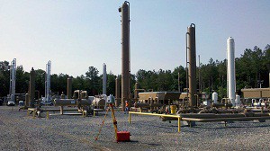
In 2011, Landpoint created an as-built model of a portion of a gas processing facility in Haughton, Louisiana. We used this innovative technology to create a model that is within ¼ inch accuracy in just ¼ day.  While using only four scanning positions we were able to capture a full 360° detailed view of the facility towers, and the entire project took only 14 days to complete. Before the development of 3D laser scanning, a project of this scope would have taken much longer and resulted in far less accurate data.

With this detailed model, multiple departments can work together to plan future expansions, renovations, or assess the status of current assets already on the ground. This collaboration results in better planned oil and gas development projects and faster results.

Why Getting a 3D As-Built Survey Makes Sense

3D Laser Scanning data and BIM go hand in hand. BIM, or Building Information Modeling, is the technology of the future being used on today’s complex construction projects. It imbeds relevant information into the data of the model such as materials, part sizes, flow rates, tensile strengths, maintenance schedules, life spans, part locations and many more. Scanning is a huge benefit to the BIM process serving as the foundation for renovation, addition or improvement projects or as an effective means to compare As-Built plans to the design model during construction. This significantly reduces costly RFI’s (request for information), mistakes and rework. This ultimately cuts down on the overall time and money spent on your oil and gas development projects.

To learn more about how Landpoint and 3D high-definition laser scanning can bring success to your oil and gas development project, contact us today.

Advancements in Oil and Gas Development with High Definition Scanning

oil and gas developmentFirst used in 1998, laser scanning is now the industry standard for making accurate measurements in even the most complicated environments. This is the future of land surveying, but it is already the norm for us.

How a 3D Laser Scanning Survey Works

A 3D laser scanning survey is appropriate for projects of all sizes, ranging from oil and gas development to historical preservation projects, thanks to advancements in workflows, software and hardware. This technology allows us to collect huge amounts of accurate data at high speeds.

High definition scanning works by moving a narrow beam of laser light across a target. The laser records millions of accurate measurements quickly, then transmits the data to a computer screen. The computer uses this data to create a point cloud that is similar to a 3D model. We also use the technology to scan multiple targets to create virtual walkthroughs, perform containment analysis, draft interactive 3D models and manage inventory.

Producing Highly Accurate Data

The accuracy of data collected with high definition scanning is far superior to that gained by conventional or GPS surveying alone. High definition scanning enables us to reach further afield and collect data in places that were once inaccessible.

Saving Time and Money

After your initial investment, high definition scanning is more affordable than conventional methods. If we need more information about your site, we don’t have to send a survey crew to get it. Instead, we analyze the models and data already collected and extract the information we need. This saves you both money and time.

Better Damage Assessment

We rely on high definition scanning to assess damaged facilities, broken drilling rigs and other problem areas. The technology allows us to quickly and accurately assess the problem and create a viable solution.

If you have never worked with a firm that offers high definition scanning, it is easy to make the switch. You get the added benefits of this technology for the same cost or even less, and get results much faster.   This technological advancement has changed oil and gas development forever. To learn more about how a 3D laser scanning survey can help you, contact us today!