Why Accurate Geospatial Data is Critical to Solar Farm Development

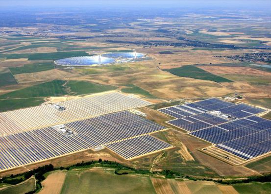
Geospatial data, including GIS, can be used throughout a solar farm development — to better analyze and simulate terrain, to identify potential issues with an on-going development, and to analyze and optimize performance. As geospatial data (and drone technology) become more advanced, it can provide more robust surveys and scanning, and more complex features.

Here are some reasons why geospatial data is critical to solar farm development today.

Collecting Data Before Development

Geospatial data can be used to survey ground before development, to properly identify boundary lines, and to find the areas that will need modifications to elevation and other adjustments. The more data that’s collected before development, the easier it will be for the development to engage in preparation and planning — and that includes estimating budgets and deadlines.

Reducing Setbacks and Reworks

Geospatial data allows for complex simulations of solar farms before ground is broken. During development, data can be used to identify the best potential layouts, given the different levels of sunshine throughout the year. Having simulations reduces the chances of future setbacks and reworks, by identifying potential issues before they become problems.

Ask any construction company, and they’ll tell you: The initial project usually doesn’t make up the bulk of the cost. Setbacks and reworks are a significant amount of the budget for a construction, simply because they require that everything be reset and redone. That also pushes deadlines back considerably, in addition to increasing budgets.

Identifying Maintenance and Repair Issues

With mobile GIS technology, solar farms can be surveyed on a regular basis to determine whether there are any maintenance issues or repair issues that need to be addressed. Without aerial surveys, solar farms require manual surveys. These surveys may not be able to pick up on maintenance or repair issues quickly, and can consequently lead to costly (and sometimes dangerous) repairs that need to be made.
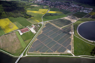
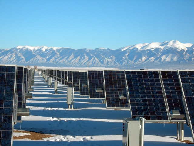
Solar panels, for instance, can overload if they get blocked up. If something falls on a solar panel and blocks the sunlight out, the panel itself needs to work harder to compensate. Drones can identify these types of problems before they lead to permanent damage, and maintenance personnel will know exactly where to go to fix the problem.

Optimizing and Analyzing Efficiency

Through geospatial data, solar farms can analyze where the sun falls, where the best production is, and how the solar farm is functioning in general. This data can be used to further optimize and analyze the solar farm’s efficiency. Solar farm efficiency is everything: The more efficient and productive the solar farm is, the more successful it is.

As solar farms become more competitive, it becomes more important to boost this efficiency with technology. In coming years, we will likely find out new things about how to optimize solar farms, and how to improve upon their yield.

Avoiding Unexpected Roadblocks

Solar farms are made across large swathes of land, often rural. It’s not always easy to identify potential problems, such as the terrain around the farm, or developments next to the farm. Geospatial data can alert developers to potential environmental issues or building-related issues around the solar farm, before they become problems.

A solar farm might need to model a development happening right next to it, and how it could impact any solar panels in that area. Solar farms might also need to model the weather, and determine how efficient their solar farm will be, to make sure that the farm is sized correctly to the desired yield.

Drones have drastically changed the collection of geospatial data, and in so doing, they’ve changed the way that solar farms can be developed. From the inception of a project to its continued maintenance, geospatial data and GIS data can be used to develop, support, maintain, manage, and optimize solar farms. 

If you want to learn more about building a solar farm, connect with us at Landpoint.

CTA-Landpoint-Wind

How Building Information Modeling Can Help Preserve Historic Locations

Building Information Modeling (BIM) is a way to take, analyze, and store complex information regarding physical architecture. BIM is frequently used to simulate new developments, but it can also be used in the restoration of historic sites.

When historic sites are damaged, or simply falling apart due to age, scans and data can be taken for the next part of the restoration process. Here are a few of the ways in which Building Information Modeling can be used to the advantage of historic preservation.

Acquire Extraordinarily Accurate Building Data

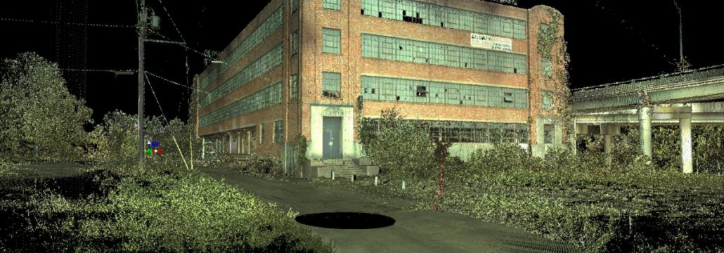
Through highly accurate, LiDAR scanning, high resolution BIM information can be taken and stored. With this data, developers, architects, and historians will be able to identify areas in which they can restore and preserve historic locations. Using simulations, different options can be modeled. From there, it’s possible to identify the solutions that will be best suited for the project.

And it isn’t just preservation information that can be simulated. Continued wear on the historic location can also be simulated, so that developers know which areas need to be protected the most. Developers will even be able to see how the historic location might be influenced by other developments in the area, and consequently plan ahead. 

When LiDAR scanning is used alongside photogrammetric imaging, even the texture and color of the buildings can be preserved. This can help with restoration attempts in the future. More data is always better; some restoration processes that aren’t available today could still be available in the future.

Get Information Without Physical Disruption

Physically walking through a historic location can cause damage to it, if even only slightly. But when drone technology is used to capture BIM, developers are able to work on the project without having physical access to it. This is critical. Otherwise, restoration might not be done properly because collecting information can’t be risked. 

Scanning with laser technologies, on the other hand, gives the developer as much information as they need while still preserving the structural integrity of the site — and that means they have the ability to do significantly more accurate planning. 

In the past, scanning from planes and helicopters would be the only option. But there’s a downside to this: scans from planes and helicopters are lower resolution. Planes have to fly too high, and helicopters can’t be flown with the same precision as a drone. And neither one can get inside a building!

Avoid Putting Physical Surveyors in Danger

Why is building information modeling important? It’s not just because it’s best for the buildings themselves; it’s also best for the people involved. Taking information through LiDAR and aerial scanning means that physical surveyors don’t need to put themselves in danger. Not only can a historic building be dangerous due to damage, but it can also be in a dangerous or in an inaccessible location.

With BIM, data can be taken before people need to physically step foot on site. BIM can be used to identify areas that are potentially dangerous before anyone needs to start work, and these areas can be marked clearly to be avoided.

Preserving Buildings in Simulations

Even if buildings themselves cannot be preserved, their data will live on forever. While the building may be able to be preserved and restored today, the buildings may fall in a hundred years, or even a thousand years. But the data that is taken regarding the building has the potential to be preserved forever.

Today, we have the technology available to rescue historic locations — and drones are an essential part of that process. With drone technology, exceptionally accurate building information modeling data can be saved, and in the future, that information can be used to restore everything to its original condition.

And, even if buildings are in good condition today, and not yet falling into disrepair, it’s a good idea to keep their information for the future. It’s possible that environmental changes could challenge these buildings in the future, or unexpected disasters such as earthquakes could strike. Buildings that have historic significance but are not currently undergoing restoration efforts are good candidates for this type of digital preservation.

Anyone who wants to preserve a building, whether historic or not, should consider the advantages of Building Information Modeling

how-to-choose-land-

Old MacDonald Had a Drone: How Land Surveyors and Agriculture Drones can Help Farmers

Agricultural drone technology is booming. As drones become more advanced — with longer flight times and better sensors, to start — they also become more useful to the agricultural industry.

Drones can be used for a multitude of applications on a farm, from initial planning to continued maintenance. And even better, farms don’t need to purchase drone technology to use it. Farmers can use drone technology services for many of these benefits, thereby creating a more cost-effective solution for otherwise time-consuming and expensive tasks.

Wondering how to use drones in agriculture? Here are a few of the most useful examples.

Measuring Crop Distribution: Improve the Productivity of Your Farm

Crop distribution is easier through aerial surveying. With aerial surveying, a farmer can easily scan their entire farm, to measure and analyze metrics such as crop distribution. Drones are able to measure crop distribution faster and more efficiently than other, more traditional methods.

Through better analysis, you can formulate plans for more efficient farming in the future. The more data you have, the more confident you can be.

Farm Planning: Simulate Your Planting and Irrigation

Through surveying, farmers are able to plan their planting and irrigation ahead of time. Surveys can be used to simulate a development before ground is broken, which is especially important in farming, where profit margins can be tight. Farmers can even simulate light and weather effects, to determine whether their irrigation is going to be efficient, and to determine whether the crops are placed correctly.

During the very initial phases of a development, surveys can also be used for land elevation. By using surveys for land elevation, farmers can identify the most cost-effective ways to pre-level their development.

Seed Planting: Plant Faster and More Reliably

Seed planting can be time-consuming using traditional methods. Drones can be used to plant more effectively, as drones can spread seed close to the ground, with high-precision coverage. This leads to less waste, and more productivity throughout the year. The larger the farm is, the more useful drones are for seed planting and seed delivery. 

Crop Spraying: Protect Crops Faster and More Efficiently

Just a decade ago, crop spraying via drone wouldn’t have been possible. But today’s drones can carry heavier loads and carry them for longer. Through drones, farmers are able to ensure that their crops are sprayed consistently and quickly, without the need for expensive equipment or manual labor. 

Drone spraying is a fraction of the cost of crop dusting, and it’s still more effective than other methods of spraying, such as spraying directly from a vehicle. For farmers who want to save money during their crop maintenance or target only dying crops, drone crop spraying is the easy choice.

Livestock Tracking: Use Heat Signatures to Track Your Livestock

Drones can even be used to track livestock. Using heat signatures, drones can be used to identify where livestock are, ensuring that livestock are where they should be and that no livestock has gone missing. Over large territory, drones can be used to find livestock quickly. This is especially useful for large farms through which livestock may roam far. You can respond to straying livestock much faster than you otherwise could, thereby ensuring that your livestock remains safe and healthy.

This isn’t all. There are many ways drone technology can be used to augment traditional farming processes. Drones can be used any time it’s important to complete scans from a planimetric view, and they can be used in conjunction with sensors and other advanced technology.

Are you wondering how drones could help your farm? Take an in-depth look at how drone surveying can help with agriculture and forestry. An agriculture drone can save you time and money—you just need a solid drone partner.

Surveys at Scale - How Landpoint Tackles Survey Projects of Any Size

What is Surveying in Civil Engineering? Why Surveyors Are Critical to Public Works

What is surveying in civil engineering? Why is it so critical? Surveying is involved in everything — from accurately drawing boundaries between private and public land, to inspecting bridges and other critical infrastructure. Without surveying, the placement, security, and safety of projects cannot be assured. Here’s an overview of how surveying works with civil engineering to make public works better.

The Relationship Between Civil Engineering and Surveying

Civil engineering is a complex discipline. In fact, it’s the second oldest engineering discipline apart from military engineering. Civil engineering is often associated with public works, but that’s not all it is. Civil engineering is any type of engineering that involves building infrastructure on top of the environment: Canals, bridges, and pipelines are most notable.

Since civil engineering involves directly impacting the environment (often in a significant way), surveys are incredibly important. Surveys make sure that protected environment isn’t adversely affected, that the structure is safe, and that the project is overall as efficient as possible.  

So, what is surveying in civil engineering? It is a critical part of every stage of a project’s development. Here are some of the ways in which surveying is so incredibly important.

Inspect High Risk Areas Such as Bridges and Other Infrastructure

Through the use of drones, bridge surveys (and other types of high risk surveys) can be completed without any risk to personnel. A drone bridge inspection is naturally less dangerous than a conventional survey, as drones can get into areas that a person could not easily (or safely) get into. Drones can fly around a bridge or other complex infrastructure easily, thereby conducting more in-depth surveys and increasing the overall safety of the bridge.

Many of the bridges in the United States are in disrepair, and it isn’t the bridges alone that are an issue. Canals, dams, and other civil infrastructure could be at risk of falling apart, because they aren’t being frequently inspected. Dams are among other, similar, infrastructure which cannot be easily inspected, and consequently may have issues that need to be repaired but haven’t yet been revealed.

Drones can fly very close to the ground, and they can hover, which means they can inspect areas that are otherwise inaccessible. And all of this makes it more likely to complete projects safely.

Collect Accurate Data for Proposals

When engineering proposals are being completed, accurate surveys can help. Public works generally require approval by the public, either through direct vote, or by voting in lawmakers who are interested in completing certain projects. And the public can be against any improvements that could potentially be very dangerous.

Collecting accurate data is essential to the future of a project. With the right drone surveys, 3D simulations can be created. As an example, a new road could impact water flows, or could cause issues of erosion for the surrounding environment.

Once accurate drone surveys have been completed, lawmakers will be able to better support their case in the public. And the public will be able to make more knowledgeable decisions overall. Data collected for a proposal could also indicate that a project is unsafe, in which case lawmakers would want to know this before they support the initiatives themselves.

Resolve Legal Issues Between Private and Public Property

Property issues can become a big dispute. When civil engineering projects are initiated, there can often be issues between public property and private ownership. Boundary surveys may be needed to resolve whose land is being developed. With drones, the data can be utilized to help determine where private land ends and public lands begin. This can prevent both costly acquisitions and the use of eminent domain.

Drones are, by far, the fastest and safest ways to conduct a regular land survey today — while they may not be able to travel at the speeds of planes, they can usually deploy much faster. This heads off legal issues before they become major problems, eliminating delays to important public works problems, and assuring citizens that only public land is being developed.

Surveying and civil engineering is critically linked, and there are many ways in which drone technology can help civil engineers complete their work. Whether the project is public or private, it’s important that the environment around the development be thoroughly scanned and surveyed. UAV technology, combined with technologies such as LiDAR scanning, can produce highly accurate, cost-effective surveys for all types of engineering projects.

Do you want to learn more about surveying and civil engineering? Do you want to invest in drone inspection? Contact the experts at Landpoint.

Surveys at Scale - How Landpoint Tackles Survey Projects of Any Size

How Drones Make Solar Panel Inspection, Installation, and Maintenance Easier than Ever

Before your solar panel installation, consider the many benefits of drone technology. Drones can be used during the process of installing, maintaining, and inspecting a solar installation. Safe, fast, and easy to deploy, drone technology is versatile and cost-effective. With drone technology, surveys can be taken with either LiDAR or photogrammetric scanning, offering useful information to the owners and maintainers of the project and system.  

Consider the following benefits of drone surveying for your next installation.

Installing Solar Panels with Drone Surveys

Before the installation occurs, drones can be used to survey the entire area. A drone survey will indicate which areas are going to be in the sunlight most often, thereby impacting the efficiency of the installation. If using photogrammetric imaging, the drone will take a number of photos from above and derive 3D data from that. If using LiDAR imaging, the drone will use a laser to create highly accurate 3D plots that can be used for simulations.

When surveys are completed, 3D simulations can also be made. These simulations will show the impact that the solar panels will have on the surrounding environment, as well as the impact the environment will have on the solar panels. Together, this provides a more accurate picture of the efficiency of your solar installation.

Traditionally, solar surveys were usually done by manned vehicles: planes and helicopters. But these are far more dangerous. A manned aerial vehicle can crash or encounter other difficulties, which can injure people. Drone surveys are safe; since they are unmanned, even a crash will not cause much damage. Further, drone surveys can be completed faster, because they don’t require the hiring of a manned crew, nor the licenses and permits required for manned surveys.

3D surveys aren’t just used to make sure that the installation is as efficient as it can be. They’re also used to avoid damage to the surrounding environment, by simulating issues such as soil erosion. 3D simulations can be so precise that they can be used to predict potential environmental issues, in addition to their use for product costing.

Drone surveys are particularly useful for this, because many companies now offer end-to-end management for simulation information, collecting data and analyzing said data nearly immediately after drone deployment.

Maintaining Solar Panels After Installation

Drones can be used to conduct surveys after solar panels have been installed, making it possible for technicians to identify potential issues. When flying over a space, a solar drone inspection can identify potential problems, such as solar panels that have been covered by dust and dirt.

In the past, technicians would need to travel on site, by ground, to determine whether there were issues with the panels. And if panels weren’t inspected regularly, there could be serious long-term damage.

But with drones, video feedback can be taken with ease, and the site doesn’t have to be walked in order to be maintained. This encourages more regular maintenance and ensures that technicians know exactly where they’re being deployed when they are being deployed.

The larger the installation is, the more important this feature will be. And as your solar deployment scales upwards, you’ll see continued improvements in your general operating costs. 

Completing Routine Solar Panel Inspections

A solar drone inspection can be used to detect issues with solar panels specifically, such as heat-related issues. If there are heat fissures or cracks forming, drones can report back the exact location of the issue, and technicians can be deployed directly. 

For safety, a drone solar panel inspection is incredibly important. Without regular inspection, solar panels can become so damaged that they need to be replaced. Regular inspection will save an organization both time and money, and will potentially reduce the risk to individual technicians.

Are you interested in learning more about the benefits of drones for solar technology? Contact Landpoint today to find out more.

Landpoint-Solar-Survey

Going Solar? Land Surveying Is an Important Early Step

If you’re going to be installing solar, a land survey is an important first step. Land surveys can improve the effectiveness and the safety of your solar installation, thereby making your solar system more efficient and productive. If you want to capture the most from your solar energy installation, solar land surveying can help. 

Build Your Solar Installation Where It Needs to Be

The efficiency of a solar power installation is greatly impacted by the placement of the solar panels. With a land survey, you’ll be able to simulate how sunlight will fall upon the areas the solar panels are positioned in. That’s going to give you a better picture of where you can capture the most energy. 

That doesn’t just mean capturing energy, it also means avoiding potential dead zones. If parts of a solar panel are consistently hidden behind shadow, the solar panel itself can malfunction. For the ideal solar power installation, you want power to fall evenly across the panels, and you want to be able to simulate how the light is going to fall through all seasons.

Light changes depending on both time of day and season, and that’s going to have a significant impact on how effective your solar installation is as a whole.

Identify Potential Issues with Topography through Land Surveying

Before you can place your solar panels, you’re going to need to review the surrounding terrain. A topographic land survey will illustrate the current relief and the amount of change necessary to achieve the greatest result. You will want to locate your panels on the most level piece of land, as leveling land is expensive, and if you level an area that is overly elevated, it will be even more expensive. During a topographic land survey, you can identify the best possible location for your site. 

Make Sure Your Surveys Are Correct

Apart from issues with topography, you also need to make sure that your land surveys themselves are correct. If you have a lot of land, and it’s rural, there’s a chance that your property boundaries need to be confirmed.

With an aerial survey, you can make sure that you’ve set your construction limits along your boundary correctly. This avoids the potential that you could develop land or place solar panels on site without realizing that the land isn’t yours, tangling your business in costly legal challenges.

Use Complex 3D Models to Build Correctly

Apart from deciding where to place your survey, land surveys can also be used to create 3D models of your installation. These 3D models can be used to determine whether the weight of the installation could cause too much load on the ground, or could lead to damaging erosion. 

It can also be used to determine the solar panel impact on the surrounding terrain, which can be useful for environmental surveys — particularly important for extremely large solar panel installations, or installations that are close to protected territories.

Maintain Your Solar Installation After Development

Land surveying isn’t just important during the development stages of your solar panel installation. It’s also important after. You can use periodic drone surveys to detect things that human inspectors wouldn’t be able to do, such as hairline cracks, or overheating panels. You can then maintain or replace these panels before they become a safety hazard. Regular maintenance checks will improve the overall efficiency of your solar panel installation, which will also mean that it will pay for itself much faster. Solar panels that are not well-maintained could eventually lead to safety risks and other hazards.

So if you are you about to install solar panels, consider getting a survey first. A survey can head off many of the risks associated with a solar panel installation, from installing it in the incorrect location, to installing it where it won’t get enough sun, to even maintaining your solar installation. Contact us today to find out more, and to get a quote for a survey

Landpoint-Solar-Survey

Why Solar Farm Construction Needs Experienced Surveyors

The solar farm construction industry is booming. Anyone with large volumes of land can consider a solar farm installation, either for their own use or to sell back energy to a grid. Business owners are starting to install solar farms, and cooperatives are putting together solar farms to be shared between their properties. But before you start your solar farm construction, it’s absolutely vital to get a survey.

Here’s why. 

What is a Solar Farm Survey?

A solar site survey is going to provide you with extensive topographical data regarding your solar site, so you can plan the solar site correctly. Solar site surveys can be done either on-foot or through aerial surveying, and either way, the surveyor will measure things like the boundaries of the site, existing improvements and the elevation of the land.

Here are the benefits of a site survey for solar installation:

  • You experience increased productivity and efficiency. Topographical information can be used to position your solar panels correctly, to capture the most energy possible. Sun positioning can change seasonally, dependent on different weather conditions and during different times of day. These can all be considered when planning an installation.
  • You can position your solar panels correctly around the environment. You can identify the areas that are least likely to be disrupted by a solar panel array, as well as the areas that are going to be less costly to level. If you’re doing an environmental survey, this may be important. You will also need to take a look at how surrounding features, such as trees or buildings, could impact your solar installation.
  • You are able to remain under budget. You can see issues with your plan ahead of time, and dodge the legal fees associated with potential border disputes. During the solar panel installation, you can use additional surveys to ensure that the panels are being placed properly. This avoids having to move the panels later on.
  • You increase the safety of your solar panel site. Surveys can identify potential issues with the solar panel installation, such as dead zones that could lead to solar panels overheating. After the solar panels have been installed, experienced surveyors can come back for maintenance surveys, to find issues such as cracks and fissures that will need to be repaired.
  • You get 3D data for advanced simulations and assessments. Your 3D data will always be available, both during the pre-construction phase, and if you decide to modify your site in the future. If you want to expand your solar panel site, you can use these 3D simulations. If you want to build something around your solar panel site, you can see how it will impact it.

There are tremendous advantages to a thorough solar farm survey. An experienced surveyor can make this even better. Experienced surveyors improve the survey process from the ground up. 

Why Do You Need Experienced Surveyors?

When it comes to a land survey, you need three things: speed, accuracy, and safety. The faster your survey is completed, the faster you can break ground on your installation. The more accurate it is, the better the solar farm will perform. And, of course, the survey must be completed safely. 

Experienced surveyors can provide all these things. An experienced surveyor will be able to produce your survey without delay and can use technology that will make the process both more accurate and safer. They will be able to identify potential boundary lines quickly, and they will be able to produce topographical data for you in a variety of formats.

Surveyors that collect data as well as process it (end-to-end surveyors) are often the most beneficial. Some surveyors send data out for outside assessment, but this introduces the capacity for errors, as well as potential delays. When data analysis is handled by the same company that collects the data, the potential for issues is far less significant.

How Can You Improve the Safety of Your Solar Farm Survey?

In the past surveys were generally done either on foot or through aerial vehicle. Both can be time-consuming, or even dangerous in certain conditions. But today’s modern surveyors use technology such as LiDAR arrays carried by UAVs. 

UAVs are able to survey a site from the air, with drones that fly close to the ground. With a UAV, a surveyor is able to produce extremely detailed surveys quickly, without any risk to a crew. This is the ideal type of survey for solar farm construction.

If you’re in the solar farm construction industry, you should consider the advantages of experienced surveyors. Contact the experts at Landpoint to discuss.

Landpoint-Solar-Survey