Oil and Gas Surveying: What You Should Know
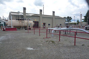
pipeline land surveying (1)Accurate mapping is crucial to the success of all oil and gas projects. Landpoint provides the most accurate and detailed maps possible by utilizing sophisticated GIS technology.These maps and tools help land departments plan their oil and gas development projects better, organize data, and build infrastructure.

GIS Mapping for Land Departments in Oil and Gas Projects

When a land department contacts Landpoint to assist in the development of infrastructure projects, our team leverages GIS mapping technologies to produce highly accurate and detailed maps. While traditional land surveying firms only produce a simple PDF plat, Landpoint’s GIS technologies produce maps and visualizations that make it easy to analyze and assess different map types and data sets while still providing the same deliverables that agents are accustomed to receiving. The large amount of data collected by survey crews on the ground is seamlessly transferred to GIS databases in our private cloud, making the information accessible to authorized parties at any time from any device. All you need to access the maps and data is a device with an Internet connecting, such as a tablet or smartphone. This accessibility coupled with the high level of detail provided by GIS technologies makes for faster, more efficient and more effective project planning and execution. Check out this demo that shows the data we manage, including well locations, ownership, pipeline centerlines and pipeline right of ways.

Why Turn to Landpoint for Oil and Gas Surveying

Landpoint’s knowledgeable oil and gas team stays committed to the customer and the project. The initial survey is only the first step in the process, and the customized services such as GIS consist of tools that provide significant value to infrastructure projects.

Unlike 97% other oil and gas surveying companies that employ less than 24 personnel, Landpoint is made up of over 200 highly trained and experienced experts. This large professional team enables us to mobilize quickly and complete projects faster. Our team has over 20 years of experience in the oil and gas industry, and we work closely with land departments to plan projects of any size.

Image by – Simon_Nathan

GIS Mapping Services: Taking Land Surveying Projects to the Next Level

land surveying companiesMany large projects rely on detailed, accurate maps. Landpoint understands the intricacies of creating accurate technical maps, and we leverage GIS technology to ensure the highest level of accuracy with the most complete sets of data. Read on to learn why GIS is one of the most important land surveying methods available to construction managers.

GIS Mapping for both Accuracy and Efficiency

Landpoint utilizes GIS mapping to capture, store, analyze and manage data with a spatial reference. This technology enables customers to better understand and analyze the data our field teams collect in a precise and efficient manner. The result is a faster turnaround time and more detailed project tracking planning for our clients.

The data and maps we create with GIS mapping give our clients extensive levels of information that help manage projects at any stage. GIS mapping gives data analysis new dimensions by providing visual representation to even the most extensive sets of data, and this helps our clients make better, more informed decisions that allow them to come to the best outcomes for their project.

More Benefits of GIS Mapping with Landpoint
  • Our GIS data and tools exist in the cloud. This means you can review your maps and survey results anywhere, including on your PC, tablet or phone.
  • GIS dataset sizes are unlimited. You can populate as much data as needed.
  • Our team has extensive experience in creating and managing GIS solutions for nearly any industry.

We use GIS technology to fill a variety of needs, including site suitability modeling, infrastructure management, utility management, 3D visualization, geospatial data acquisition and creation, site selection and prioritization, cartographic services, real estate and business mapping, base mapping and more.

To learn more about our land surveying methods and how we use GIS mapping in the oil and gas development industry, check out this demo. It shows the data we manage, including well locations, ownership, pipeline centerlines and pipeline right of ways.

Image by – Jesse Varner

Land Surveying Services for Every Need

land surveying servicesLand surveying services provide the market’s most accurate maps by using advanced techniques and the most cutting-edge equipment. These maps and the data they include are used to plan efficient solutions to a wide variety of projects.

Environmental Land Surveying Services

Highly-trained and experienced land surveyors create innovative solutions and gain ecological approvals through wildlife studies, developing wetland strategies, conducting overall environmental reviews or environmental impact assessments and creating sustainable storm water management solutions and creative mitigation strategies.

Land Surveying Services for Civil Development

Landpoint provides support for services like feasibility studies, irrigation design, traffic studies, tree inventory, environmental preservation plans, theme development, construction management, cost estimates, site selection, site inventory, code review and urban design, our land surveying services creates effective solutions for civil development projects that maximize clients’ investments.

Land Surveying Services for Oil and Gas Development

The accurate data collected by land surveyors supports complex projects in the oil and gas industry. We offer siting and permitting support, including aerial mapping, regulatory analysis and site reconnaissance, design support, including 3D laser scanning, GIS, and construction support, such as staking, restoration mediation and detailed as-built surveys. Revise sentence structure.

Residential Land Surveying Services

Our residential land surveying services take an integrated approach to residential development that includes land evaluation services, such as topographical surveys, renewable energy assessments and boundary surveys, land use entitlement services, design planning and construction services, including lot surveys and construction coordination.

Land Surveying Services for Commercial Development

Our team streamlines land-use entitlements while creating eco-sensitive solutions through site constraint analysis, renewable energy investments, field surveys, due diligence investigations, project management, traffic analysis and more.

Land Surveying Services for Transportation

We work with civil engineering firms to help create more effective transportation systems through traffic impact studies, traffic data collection, parking system analysis, transportation planning studies, and 3D scanning technology that enables us to better understand the impact of traffic operations.

Image By – dan

GIS Consulting Services for Intelligent Transportation Systems

GIS mapping, GIS consulting GIS consulting services provide critical assistance for planning, maintaining, evaluating and managing the infrastructure of transportation systems around the globe. Intelligent transportation systems are based on the results of GIS consulting, enabling decision makers to prioritize their work and make the best choices. With GIS mapping technology, you can build rich, dynamic and detailed mapping applications that will guide your project from start to finish.

How GIS Consulting Services Help At Every Stage of Development

Transportation planning projects stem from a lifecycle that starts with the planning stage and includes design, environmental management, asset and maintenance management, construction, operations, safety, security management and more. GIS mapping is an essential element of each step in this process, producing tools like as-built drawings, multi-layered data maps and more. The performance of a transportation system and the productivity of employees both increase when these GIS tools are utilized.

During the initial planning stage, GIS mapping helps transportation pros analyze their projects in regard to a variety of factors, including environmental, land-use and energy consumption factors. GIS mapping brings all these factors together in one easy-to-use medium.

GIS consulting during the design stage benefits engineers by producing detailed imagery, elevation models and critical environmental information. Design and financial software can easily be integrated into a GIS, making construction cost estimations simpler.

One of the most important applications of GIS mapping during the planning of transportation systems is environmental management. Through GIS maps, project planners can better understand environmental issues, determine eco-friendly solutions and identify the impact of their decisions on the environment. Growth issues are addressed through integrated information regarding land-use, employment density, housing and other factors. This information helps planners make better decisions regarding environmentally-sensitive matters.  Having a detailed design plan displayed within GIS allows the engineers and planners see the effect every option will have on the land and economy surrounding the project before even breaking ground.

These are just a few of the ways Landpoint’s GIS consulting services and GIS mapping services can improve your transportation projects. Learn more about how GIS mapping can help you through every stage of the process by contacting us today!

Image By –  edibleoffice

How GIS Mapping Services Can Reduce Future Setbacks of A Project

gis mappingEven the best-planned projects can be riddled with costly setbacks.  A well designed GIS serves to dramatically reduce these setbacks by providing the most accurate, up-to-date GIS mapping data to project management at all times.  When utilized across multiple tasks, positions, and departments, our integrated GIS services eliminate the frustration of duplicated efforts and miscommunications at the source of most project setbacks.
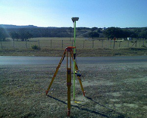
What are GIS Mapping Services?

GIS mapping services provide a highly detailed view of your data displayed alongside aerial imagery, hybrid base maps, land use and ownership information, and countless other options masterfully combined to result in a product tailor-made for your exact needs. This product is then updated and edited around the clock to provide you with real-time GIS mapping data at all times for improved decision making in each and every task.

Partnering GIS Mapping With 3D Scanning Services

When used in addition to GIS mapping, 3D Scanning services and visualizations are particularly useful in monitoring structural integrity at all stages of project development.  By utilizing 3D scanning, Project managers can approach their duties with more detailed information than ever before. In doing so, tasks can be assigned more effectively and achieved more efficiently while saving time and funds that were previously wasted during unforeseen setbacks.

These setbacks, delays, and miscommunications can occur for any number of reasons throughout the life of a project.  Our goal is to provide you with industry leading GIS mapping services that will effectively reduce and eliminate these issues while providing constant feedback and support for the long-term success of your project.  For more information on how we can help eliminate costly setbacks in your project, contact us today.

Image By – Jesse Varner

Need an Alta Land Survey? Get It Made With HD Scanners

land-survey1To assist our clients in designing and executing projects in the most efficient way possible, Landpoint relies on the very latest high definition scanning technologies when creating an ALTA land survey. These innovative technologies help our project managers and outside engineers and architects visualize all the components of any site or facility, and it allows us to make better decisions based on the building conditions.

We utilize high definition scanning to meet a variety of professional land surveying needs, including pre-project scanning, the creation of traditional 2D drawings, change detection, catastrophic event mapping and accident reconstruction, and it is particularly helpful in completing scans for ALTA certification.

Using high definition laser scanning, we can complete a field survey for ALTA certification in just one day. In less time than ever before, we can produce fully interactive 3D models, maintenance materials and detailed animations, including complete fly-trough’s alongside the traditional materials expected from an ALTA land survey.

As a professional land surveying firm, high-def laser scanning benefits our clients in many ways:

Reduced Cost

Using the technology significantly reduces the amount of field visits our team has to make to collect data. This cuts the overall cost to you, resulting in more cost-efficient projects.

Future Planning

The data we collect through high definition laser scanning is not just valuable for your current projects, but can be saved and used for your future projects as well. The accurate, detailed data makes future planning far easier.

Quality Assurance

The data collected using high definition scanning is highly accurate. This ensures that your project will be based on the most solid knowledge of your site.

Speed

High definition laser scanning enables us to collect accurate data more quickly than ever before. Instead of taking weeks or months to complete your project, we can have it finished in just days.

This technology gives project managers insight into their locations that was never available before. The result is better project planning, easier decision making and overall more successful projects.

To learn more about getting an ALTA land survey and how HD laser scanning can benefit you, contact us today!

Image By – survcentex

3-D As-Built Survey in Oil and Gas Development

oil-gas-as-builtUsing the latest 3D high-definition laser scanning equipment and high end 3d modeling software, Landpoint is able to create as-built intelligent models with incredible accuracy. This technology is particularly useful for oil and gas development.

A New Type of As-Built Plan

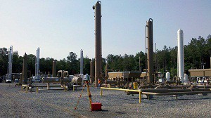
In 2011, Landpoint created an as-built model of a portion of a gas processing facility in Haughton, Louisiana. We used this innovative technology to create a model that is within ¼ inch accuracy in just ¼ day.  While using only four scanning positions we were able to capture a full 360° detailed view of the facility towers, and the entire project took only 14 days to complete. Before the development of 3D laser scanning, a project of this scope would have taken much longer and resulted in far less accurate data.

With this detailed model, multiple departments can work together to plan future expansions, renovations, or assess the status of current assets already on the ground. This collaboration results in better planned oil and gas development projects and faster results.

Why Getting a 3D As-Built Survey Makes Sense

3D Laser Scanning data and BIM go hand in hand. BIM, or Building Information Modeling, is the technology of the future being used on today’s complex construction projects. It imbeds relevant information into the data of the model such as materials, part sizes, flow rates, tensile strengths, maintenance schedules, life spans, part locations and many more. Scanning is a huge benefit to the BIM process serving as the foundation for renovation, addition or improvement projects or as an effective means to compare As-Built plans to the design model during construction. This significantly reduces costly RFI’s (request for information), mistakes and rework. This ultimately cuts down on the overall time and money spent on your oil and gas development projects.

To learn more about how Landpoint and 3D high-definition laser scanning can bring success to your oil and gas development project, contact us today.

GIS Mapping has Revolutionized Pipeline Surveying

pipeline surveyingWith the ability to manage, analyze, edit, and display data in a multitude of ways, it’s no wonder Geographic Information Systems (GIS) have become an integral part of pipeline surveying and development. Our GIS techniques incorporate first class technology and professional know-how to provide our clients with the very latest pipeline data displayed in real-time at each stage of planning, development, and construction.

What is GIS Used For During Pipeline Surveying?

From the original survey shots for easements and centerlines, to the planned and proposed phases, and all the way up to the finished As-built pipeline, GIS provides the methods to track your data every step of the way. Even multiple re-routes can be kept fully up to date and available to you when time and decision making are of the highest importance. Field crew members, Project Managers, Construction teams, Regulatory Personnel and everyone in between can utilize our GIS services to conduct their tasks more efficiently than ever before.

Pipeline attributes can be very extensive and difficult to organize, but an efficient GIS eliminates this issue. Pipeline size, asset product, grade, wall thickness, length and much more are all made easily available to you both in the office and in the field through our Mobile GIS technology. Pipelines can also be classified and displayed according to their type: Trunkline, Gathering, Lateral, etc. for a clear, concise picture of product flow from the well site to the final destination. From the start of construction to the final regulatory review, our GIS services are aimed to facilitate effectiveness in each and every task for a successful pipeline surveying project.

With an efficient GIS in place, all pipeline data can be housed in a single, well organized location and utilized by multiple positions, departments, and industries each with their own focus and tasks. To learn more on how Landpoint, Inc. GIS mapping can bring success to your pipeline surveying project, contact us today.

Image By: Wessex Archaeology

Solar Energy Plant Development Using GIS

solar energy plant GIS is a powerful tool that makes it easy to collect, store, manipulate, analyze and display accurate information in a geographically organized manner. Using this geographically referenced data, clients can visualize trends, patterns and relationships in the data so they compare the suitability of multiple locations for solar energy plant development.

Using GIS for Renewable Energy Projects

GIS maps begin as simple geographic maps, but they become so much more. We can add an infinite number of datasets to the base map, creating multiple layers of information. Then, we make the maps interactive so you can easily look into specific information for your project, while not losing track of the big picture. GIS plays a critical role in placing solar energy plant projects by allowing planning commissions, policymakers and others to decide which locations are best for developing solar energy with the least amount of impact on the population.

Applications of GIS Data for Solar Projects

This tool also reduces the environmental and social impact of solar energy plant projects. By displaying spatial variables in an easy-to-understand manner a GIS map can help project managers avoid major project complications. GIS can make it more apparent when there are patterns in the data and highlight details that may have been overlooked when seen in a less coordinated fashion.

For example, with the ability to view multiple datasets in just one GIS map, project planners can compare historical ambient temperatures and solar radiation levels in various locations. This allows them to select optimal locations for a solar energy plant’s location.

Through the map, users can calculate the solar radiation available on building rooftops, build digital elevation models and analyze the effect changes in orientation, elevation, and topographical features. Easy-to-use web-based GIS maps take this data and present the logistics of solar energy investment to everyone who needs access. With these web-maps companies can display and share large amounts of data across departments or even between organizations so everyone has a chance to use the data to come up with the best solution.

The Importance of GIS for Solar Projects

This simple yet powerful tool has an intuitive interface that changes the way we view solar energy and opens the door for larger, more widespread projects. Using GIS for renewable energy projects improves the way we deliver and produce energy and supports the development of cleaner, smarter and more eco-friendly methods of energy production. To learn more about how Landpoint and GIS Mapping can bring success to your energy project, contact us today.

Image By: pgegreenenergy