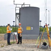
GIS Mapping Services: Taking Land Surveying Projects to the Next Level
 Many large projects rely on detailed, accurate maps. Landpoint understands the intricacies of creating accurate technical maps, and we leverage GIS technology to ensure the highest level of accuracy with the most complete sets of data. Read on to learn why GIS is one of the most important land surveying methods available to construction managers.
GIS Mapping for both Accuracy and Efficiency
Landpoint utilizes GIS mapping to capture, store, analyze and manage data with a spatial reference. This technology enables customers to better understand and analyze the data our field teams collect in a precise and efficient manner. The result is a faster turnaround time and more detailed project tracking planning for our clients.
The data and maps we create with GIS mapping give our clients extensive levels of information that help manage projects at any stage. GIS mapping gives data analysis new dimensions by providing visual representation to even the most extensive sets of data, and this helps our clients make better, more informed decisions that allow them to come to the best outcomes for their project.
More Benefits of GIS Mapping with Landpoint
- Our GIS data and tools exist in the cloud. This means you can review your maps and survey results anywhere, including on your PC, tablet or phone.
- GIS dataset sizes are unlimited. You can populate as much data as needed.
- Our team has extensive experience in creating and managing GIS solutions for nearly any industry.
We use GIS technology to fill a variety of needs, including site suitability modeling, infrastructure management, utility management, 3D visualization, geospatial data acquisition and creation, site selection and prioritization, cartographic services, real estate and business mapping, base mapping and more.
To learn more about our land surveying methods and how we use GIS mapping in the oil and gas development industry, check out this demo. It shows the data we manage, including well locations, ownership, pipeline centerlines and pipeline right of ways.
Image by – Jesse Varner


